On our last day together in Ireland Monique and I were staying at Howth Harbour overlooking Dublin Bay. We had decided to take a walk round the Head following the Bog of Frogs Loop and Purple Arrows. Here is adapted the website description interspersed with my own photos. And here is a map of the route taken.
Howth Head, a peninsula 15km northeast of Dublin City, has been immortalised in James Joyce’s Ulysses. Howth is a bustling village that offers visitors a myriad of attractions including Lambay Island, Ireland’s Eye, Howth Castle, The National Transport Museum, the Martello Tower and the Baily Lighthouse. Wildlife enthusiasts will adore Ireland’s Eye and its bird sanctuary which boasts guillemots, razorbills, fulmars, gulls and gannets. This loop is the longest of four (about 8 miles) and we started from our studio rental in the heart of the village opposite the harbour, walking along the harbour before climbing away from the village around the Nose of Howth and onto the cliff tops. Take in the stunning views of Lambay Island and Ireland’s Eye. We passed the Baily Lighthouse on our left and entered the second section of cliff paths. Leaving the coast after Red Rock, we climbed to circle the Ben of Howth and returned to Howth Village via the route of the old tramline.
A-B. Starting from the DART Station follow the purple arrow onto the promenade along the harbour. You are also following green, blue and red arrows for other shorter loops. At the end of the prom, veer right onto Balscadden Road and ascend to reach Kilrock car park from where you join the well trodden cliff path.
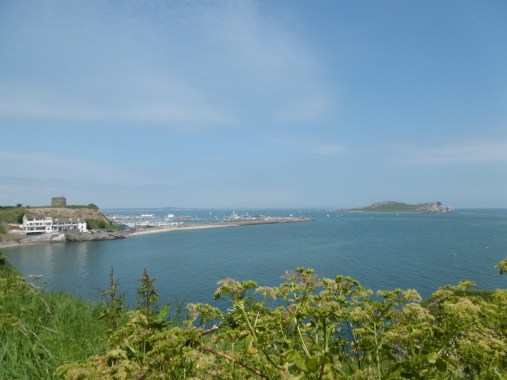
Howth Harbour and Ireland’s Eye
B-C. Follow the cliff path for approximately 3km before the green, blue and red loops turn right and ascend to The Summit car park. You continue straight on here to reach the access road for the Bailey Lighthouse. Cross the road and join the second section of cliff path.

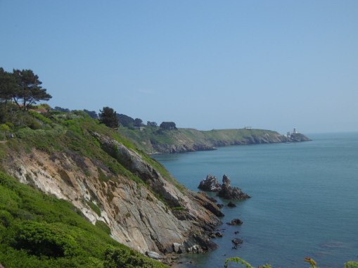
Finally on the cliff path
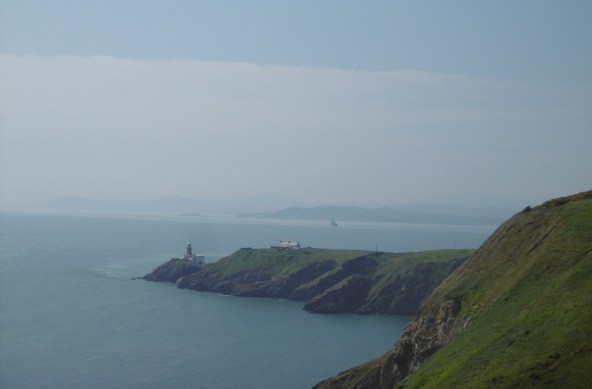
Baily Lighthouse and Dublin Bay
C-D. Continue to follow the cliff path for another 3km to pass safety handrails at Red Rock. Shortly afterwards, the loop swings right and uphill onto a grassy track. After 500m you cross the busy Carrickbrack Road and enter a hillside section.
Looking back to Baily Lighthouse
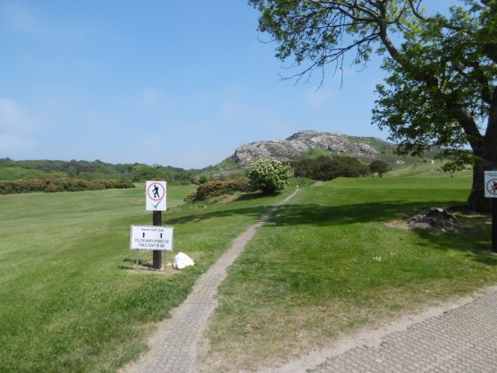
D-E. The track takes you around the shoulder of Sheilmartin Hill to enter a golf course. Cross the course carefully – using the line of white rocks as your line of travel. On the opposite side enter the Bog of the Frogs area.
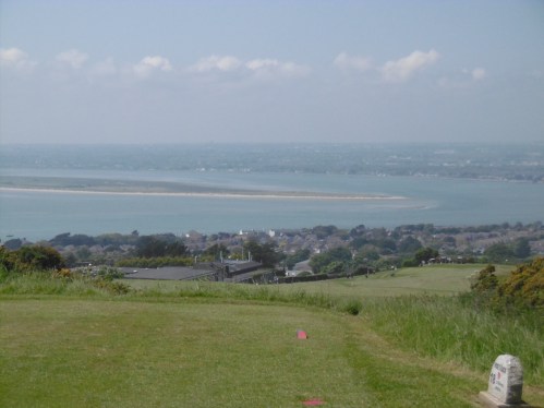
Dublin and North Bull Island from the Golf Course
Heading for the ‘Bog of Frogs’
E-F. You now follow a track through the Bog of the Frogs and onto open hilltop on the shoulder of the Ben of Howth where you pick up the red loop before descending through the grounds of the local GAA Club, and eventually reaching the Balkill Park estate.
F-A. Entering Balkill Park, you pick up the green and blue loops as you join the tramline pathway. Follow the pathway downhill to exit directly opposite the DART Station – picking up the green, red and purple loops along the way.
Don’t ask me what the Bog of Frogs is as I have no idea!

I’ve seen that lighthouse more than a few times from off the ferry sailing into Dublin.
I’ve been to Howth once, on a cold winter’s day. So didn’t do the coastal walk. Having read this will have to make another visit sometime when I’m over there.
I think Howth is well worth another visit and there are various lengths of walks beginning with the same coastal path and turning inland at some point. Our walk was especially varied with wonderful views. All the paths are well indicated which saves time reading instructions.
Lovely day, lovely views, so many choices of paths!
Indeed, Fran!