Properties at Peppercombe

Bridge Cottage Peppercombe

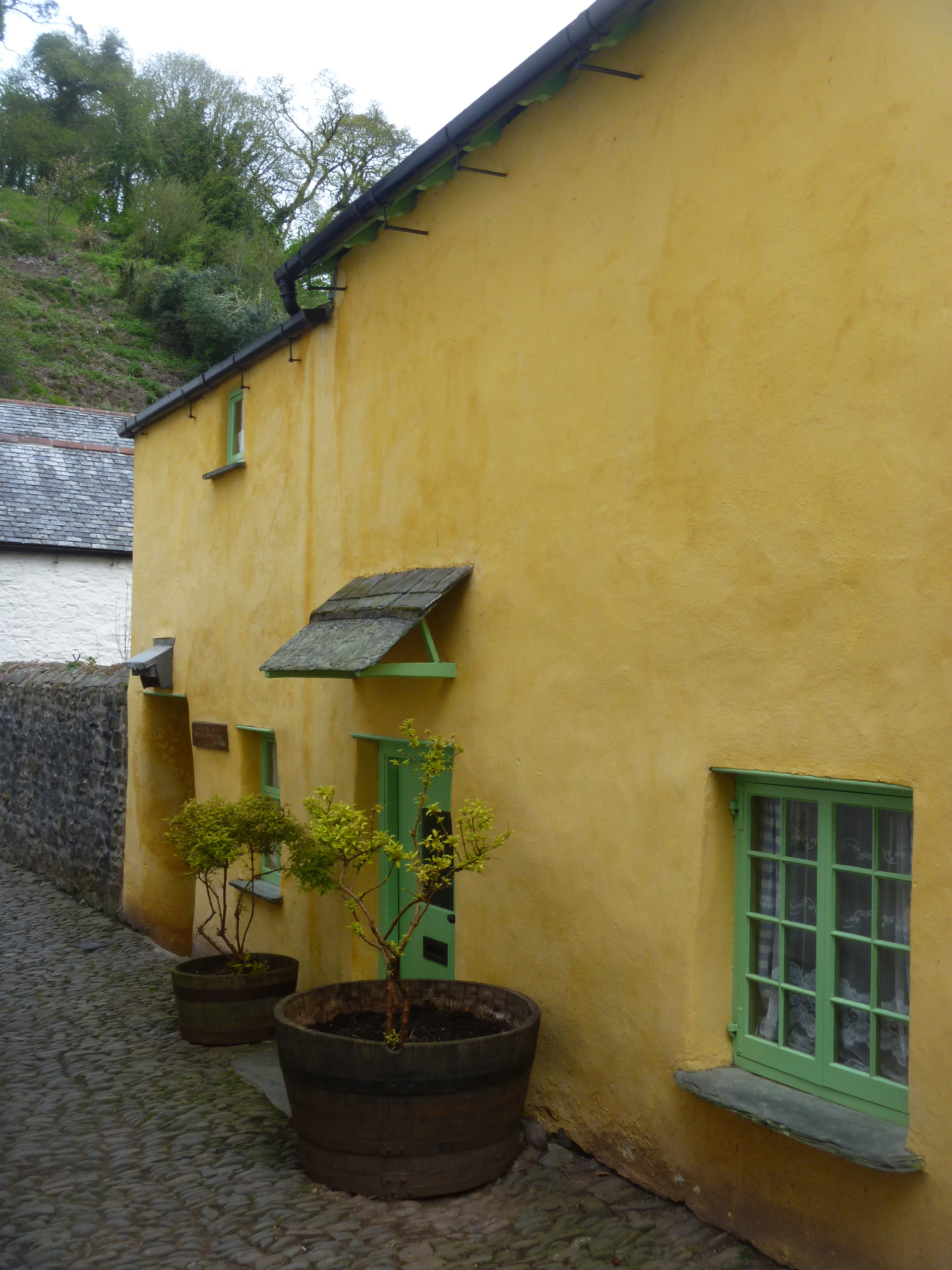
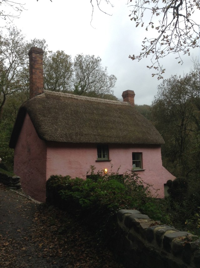
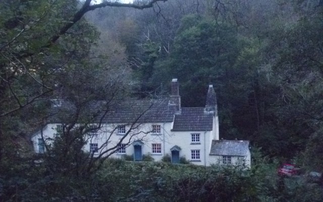
Bridge Cottage, Peppercombe

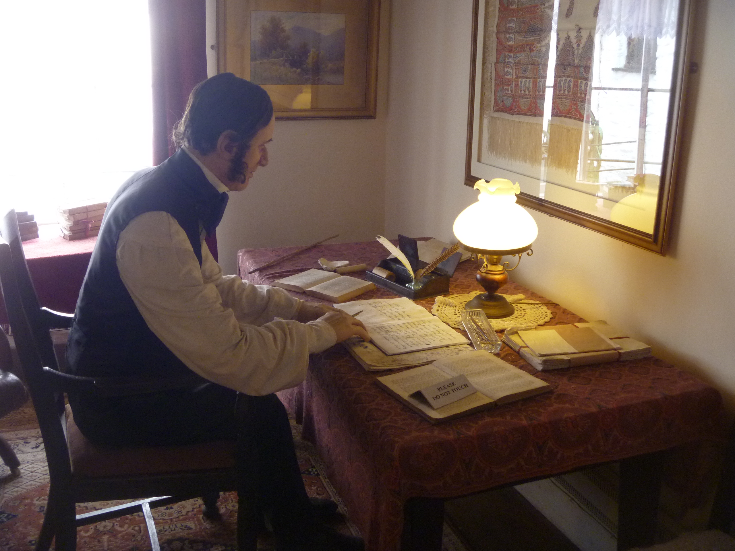
In the evening at Bridge Cottage I found a little book on the library shelves :
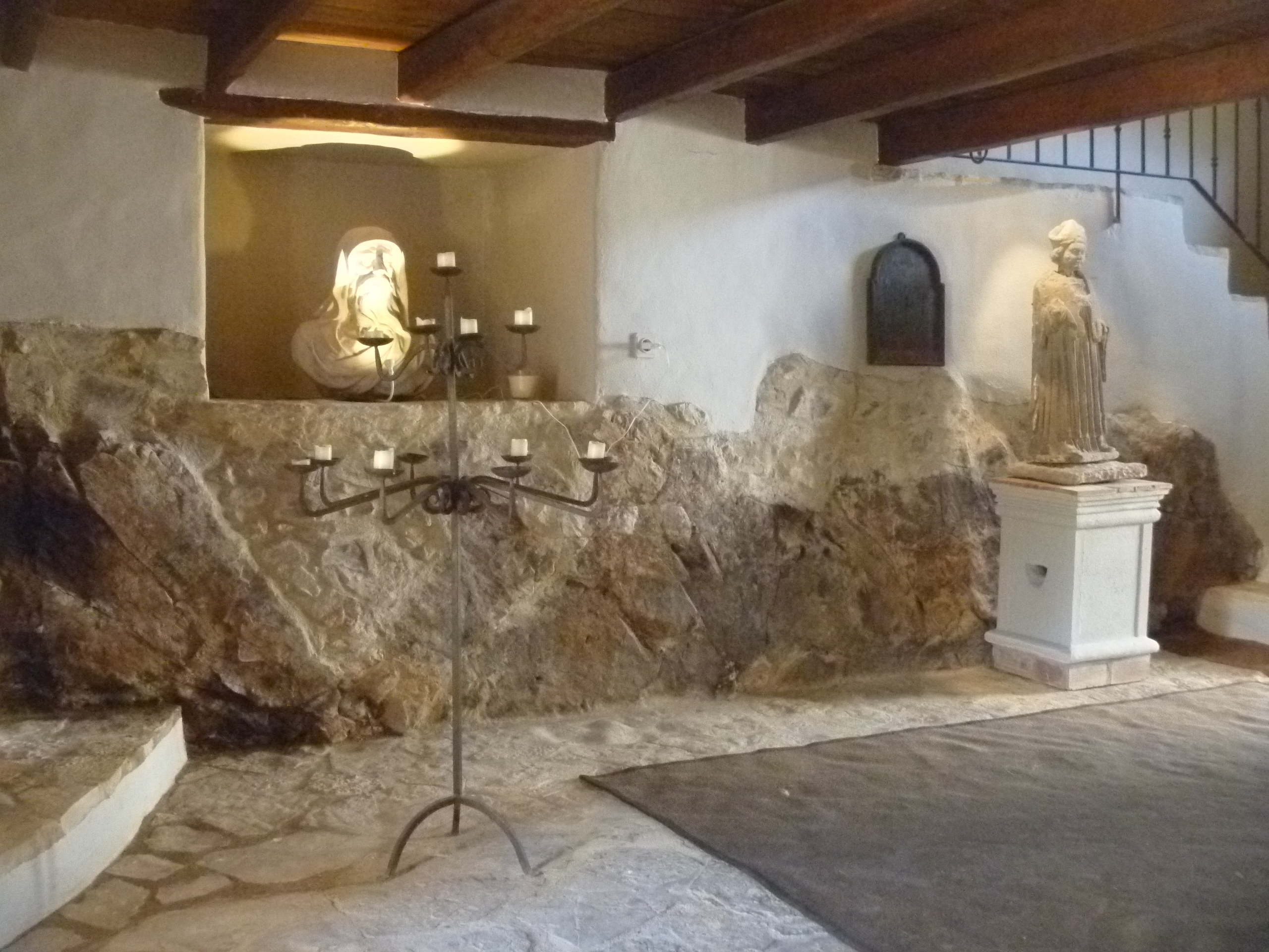
Peppercombe book

Midway down the valley , deep in the woodland beside the first of the bridges , stands Bridge Cottage. Built about 1830 of stone and cob, it has stood derelict for years, suffering the onslaught of both weather and casual vandalism. Now pink -washed and with a good thatched roof and chimney once more, it is home to holidaymakers throughout the year. Christmas sees fairy lights at its tiny windows and woodsmoke coming from its chimney.

Bridge illustration

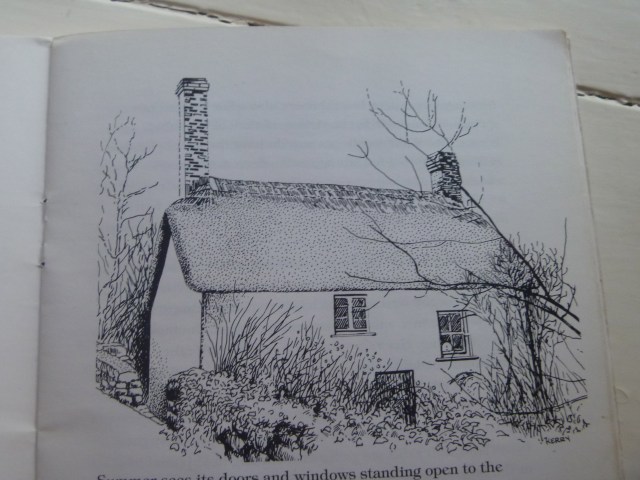
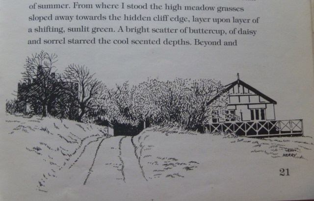
Bridge Cottage sketch by Kerry Garrett

Summer sees its doors and windows standing open to the sunlight, the woodland views, the birdsong, the splash and babble of the stream let as it cascades under the bridge by the cottage and onwards down the rocky slope. Mary Elizabeth , aunt to a very old friend of mine Eileen Tucker (who was born in Peppercombe) , lived in Bridge Cottage for a good 60 years. She came there as a bride in 1910 or thereabouts , and only left in the 1970s when she went to live with her niece. It was Mary Elizabeth who planted – tilled is the more usual word in these parts – the rhododendron and the lilac by the cottage that still bloom so richly when spring comes.” [1996. Prominent Press for Sappho Publications]

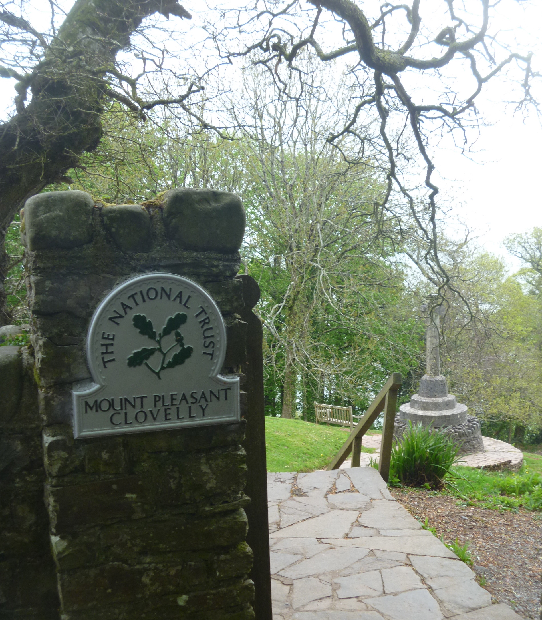
But before I settled down to read that book in the cosy sitting room with its glowing fire (its woodsmoke coming from the chimney!) I had been for a walk right along the valley to the sea. Entry to the lane from the main road at Horns Cross is by padlocked gate and I walked down to the cottage from there.

Map P'combe bk

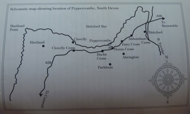
Map showing Peppercombe and surrounding areas

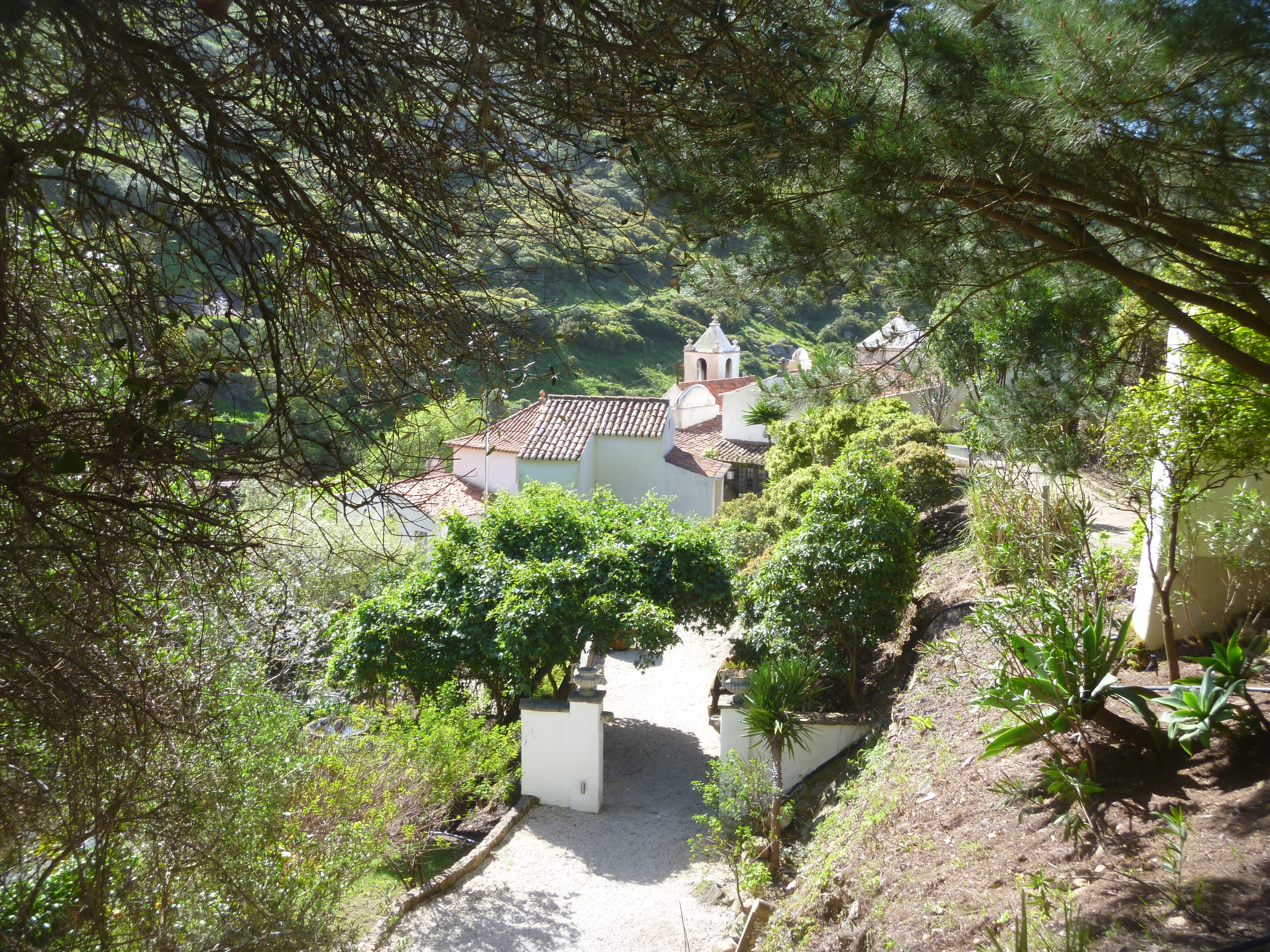
From the cottage the track goes down, down, down passing some other properties (also holiday cottages but part of the National Trust portfolio) :

NT cottages, Peppercombe

Coastguard Cottages (NT)

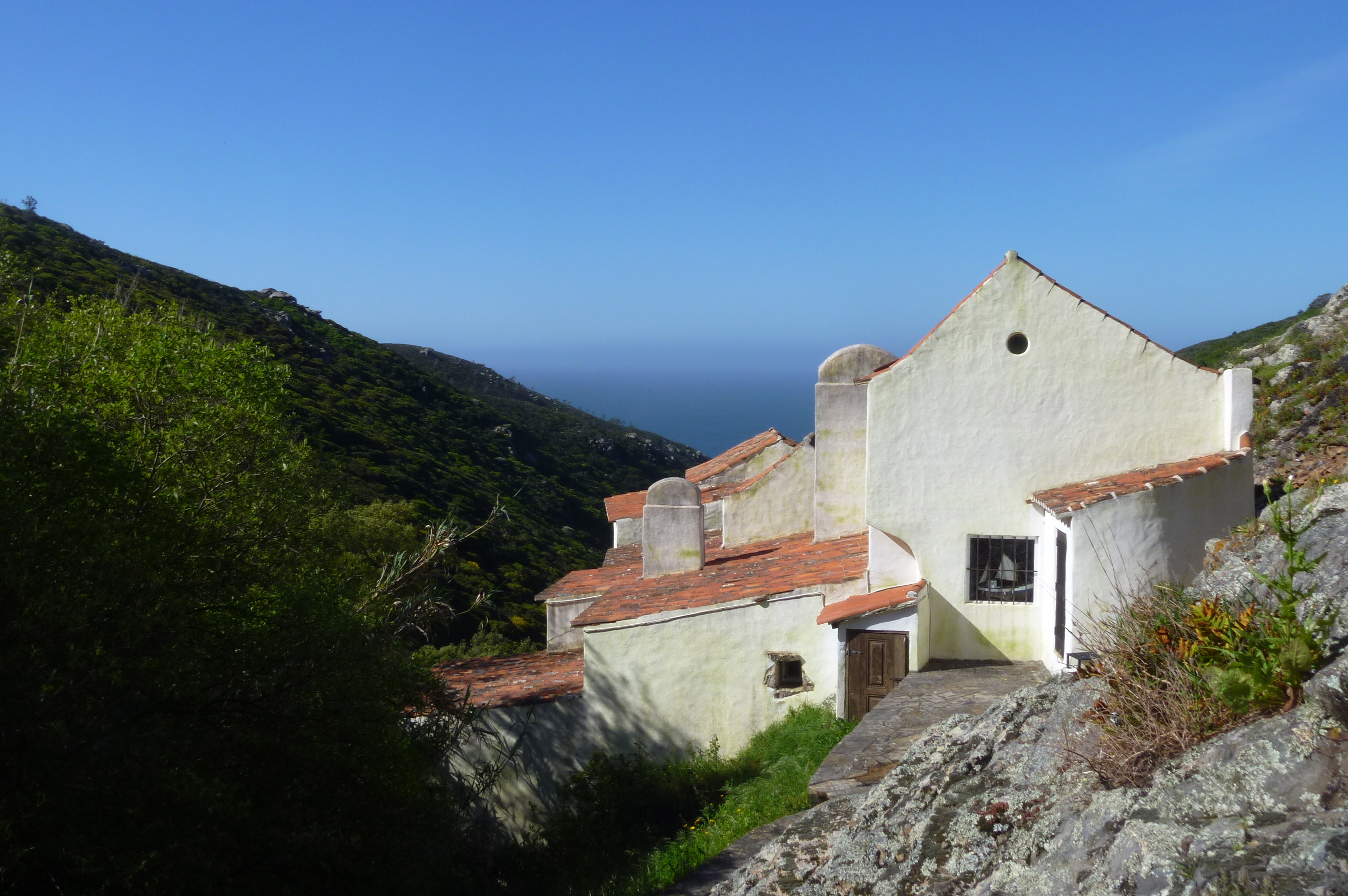
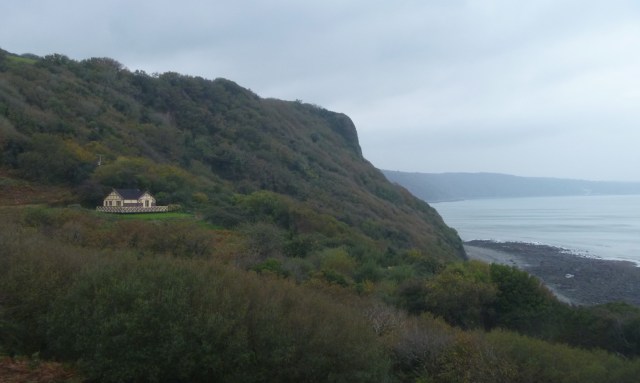
As the view opens up and the sea is revealed there on the left is an unusual building. It looks like a cricket pavilion and is painted brown and cream like the old Great Western Railway livery. It’s Castle Bungalow. Another Landmark Trust property. No-one was there so we crept around it and peeped through the windows. (Perhaps it should count as number five and a half?)

Castle Bungalow enjoys magnificent views of the coastline from the verandah. The bungalow reflects a more recent strand in Peppercombe’s history. Since the early 19th century, there has been a growing appreciation of it as a place to be valued for the beauty of its scenery. You can enjoy the views from inside this 1920s Boulton and Paul bungalow from the snug wood-lined rooms and lattice windows.” [source]
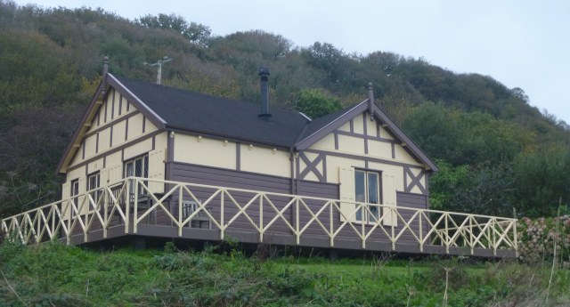
CB closer

Castle Bungalow

Like me, the Castle Bungalow comes from Norwich! Boulton and Paul, the manufacturer, was a well-known and thriving industry when I was growing up there in the 1950s and 1960s.

The Landmark Trust handbook says : A catalogue in the Boulton and Paul archive advertises Residences, Bungalows and Cottages ranging from a substantial six-bedroom house on two storeys (at £4,000) to Bungalow B49 with just a bedroom, a living room and a verandah (in case you should live in the tropics). This, with brick foundations and carriage paid to the nearest goods station cost just £280.

CB Welcome tray

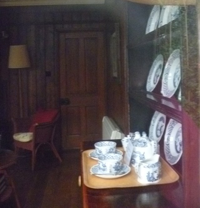
The Castle Bungalow Welcome Tray (through the window)

As it says in the Boulton and Paul website link above “Nothing too big, too small, or too difficult, was outside the scope of their ingenuity.”

Castle B in book

Drawing of the bungalow from the Peppercombe history book

CB and sea

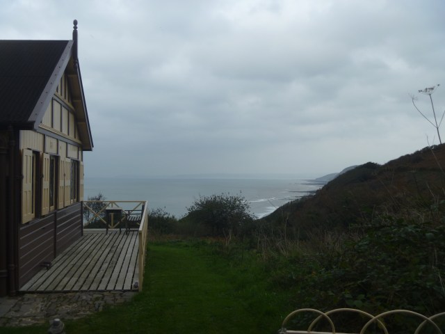
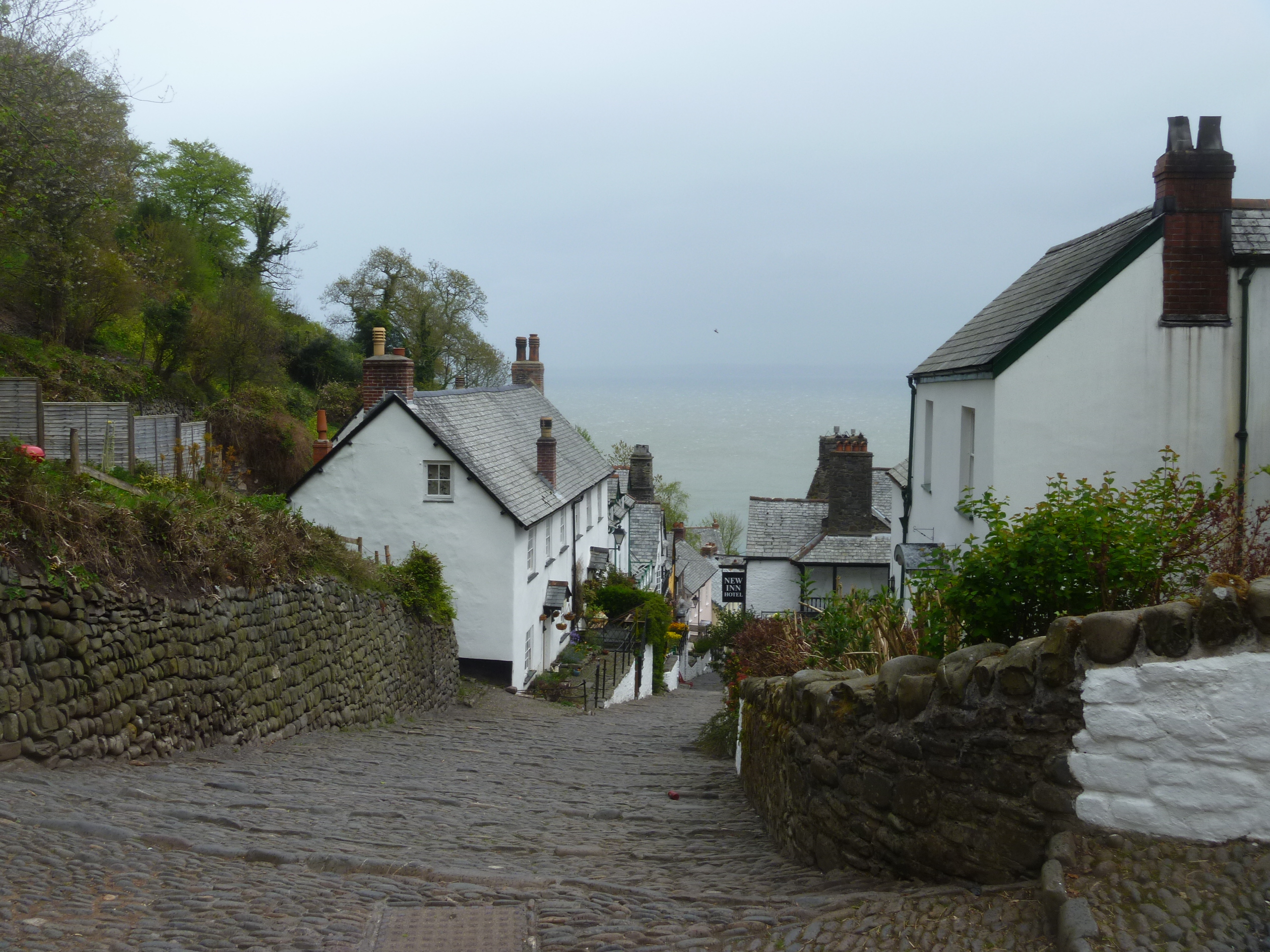
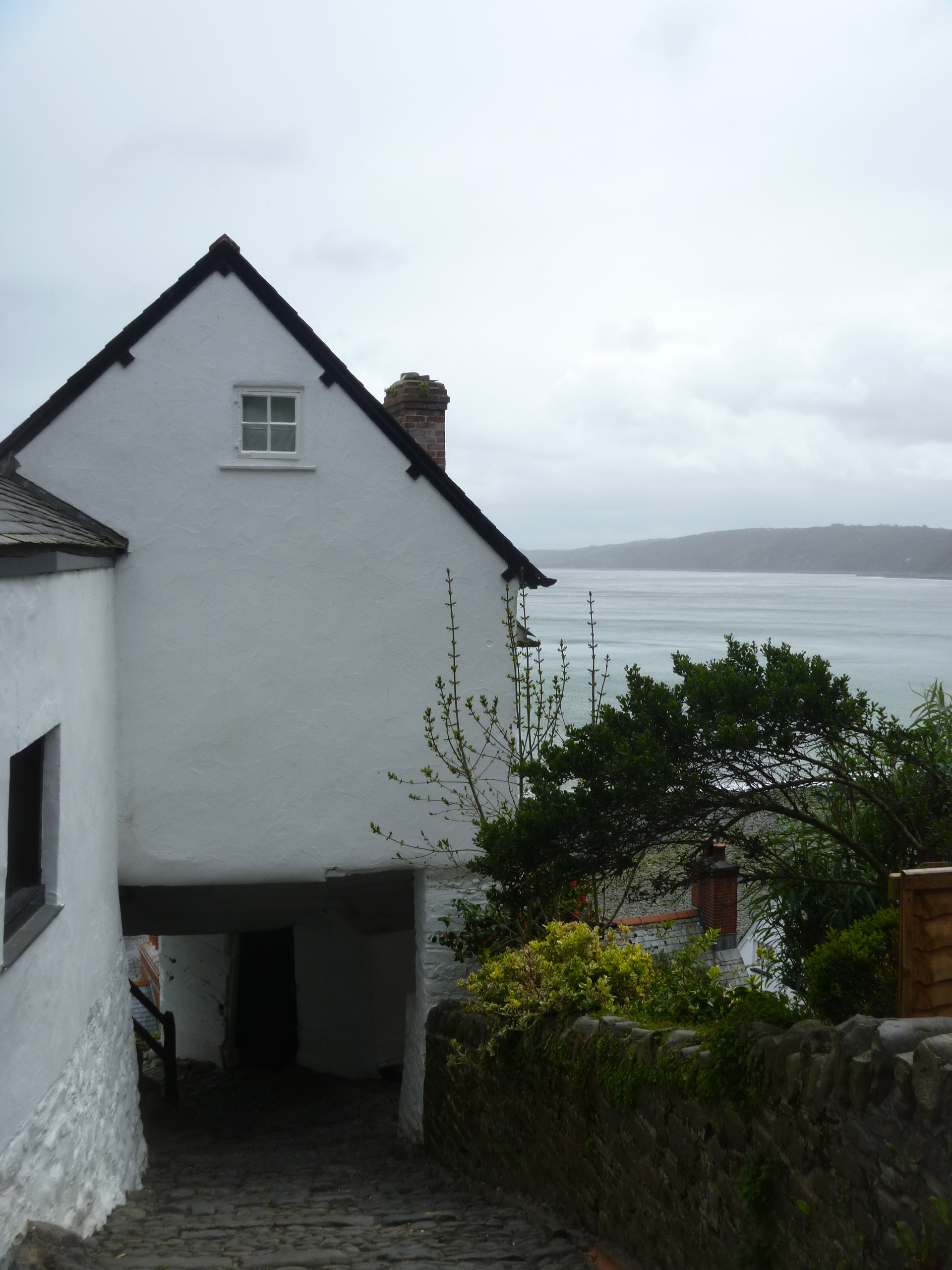
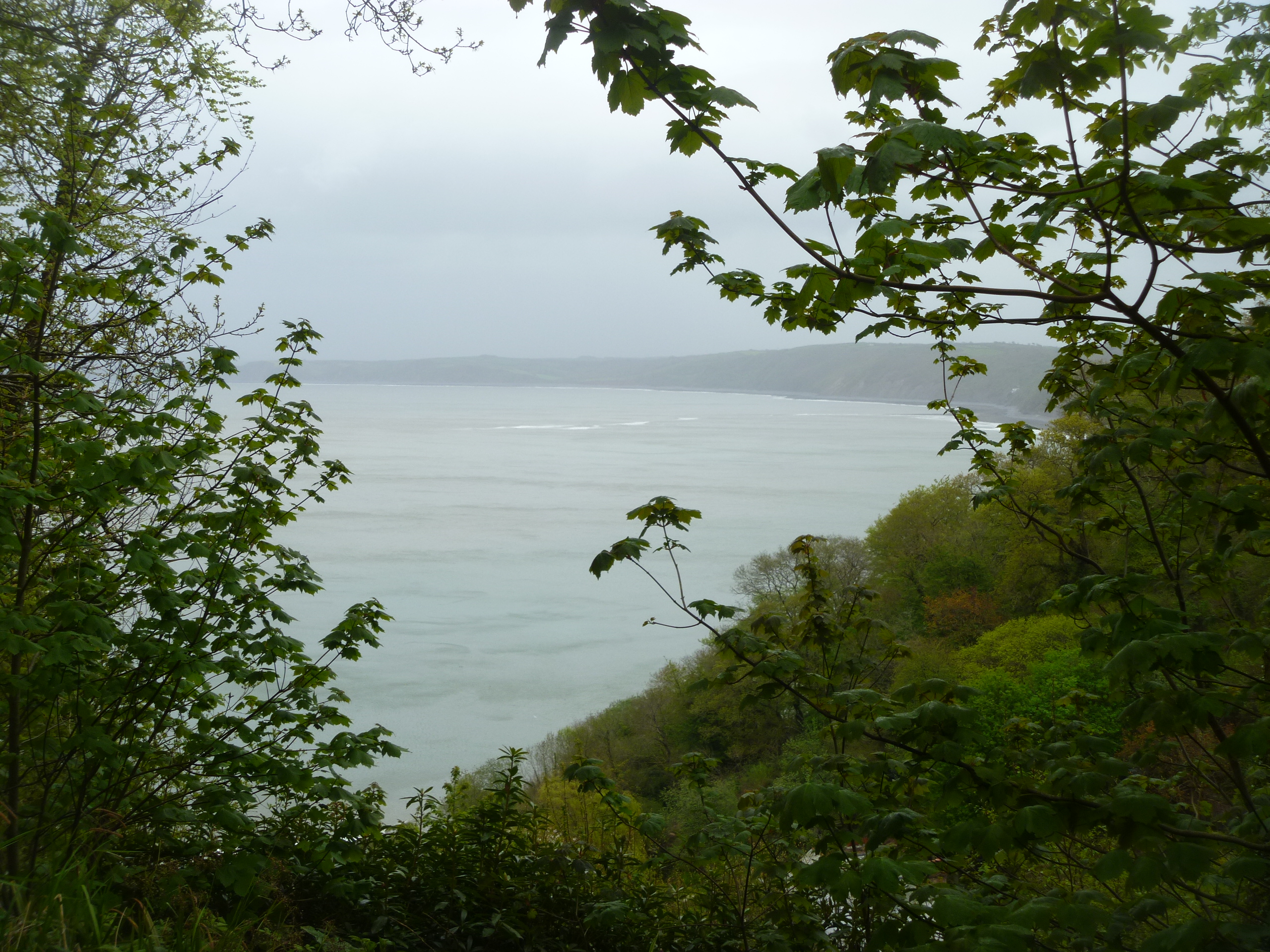
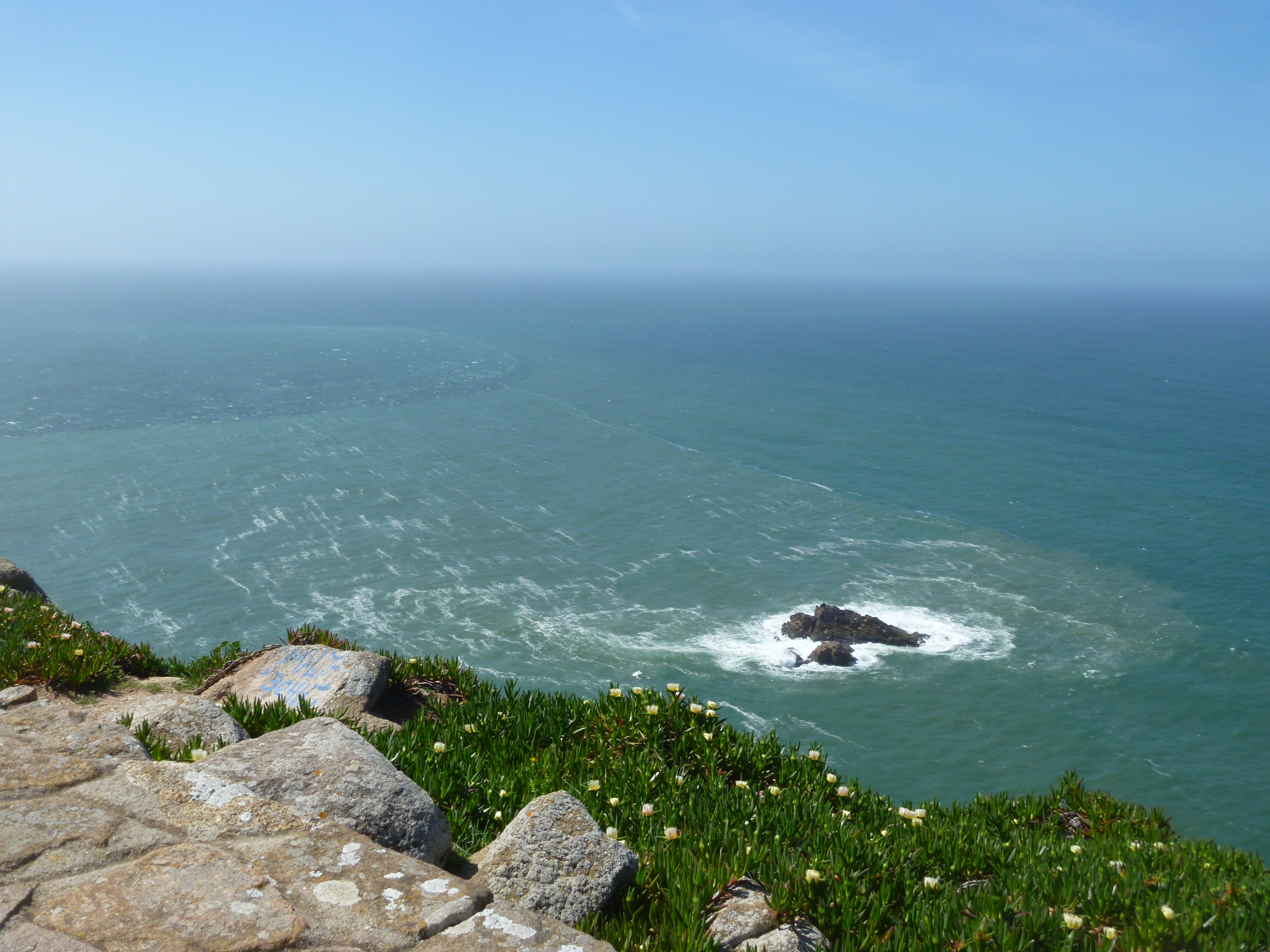
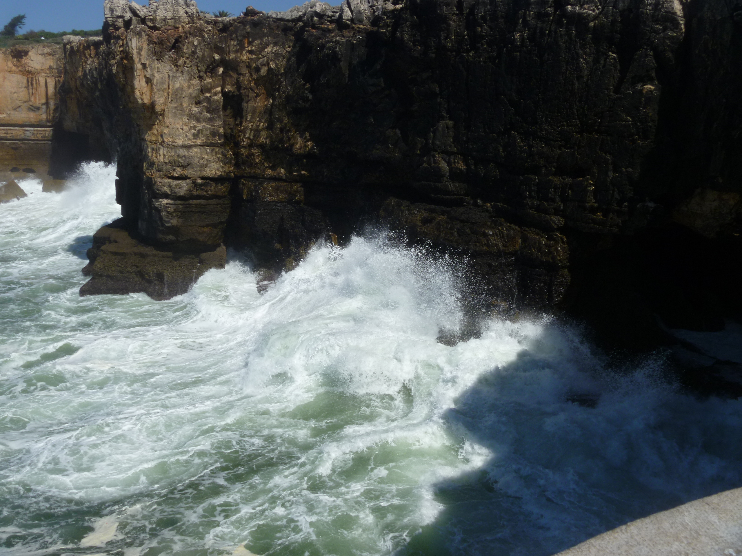
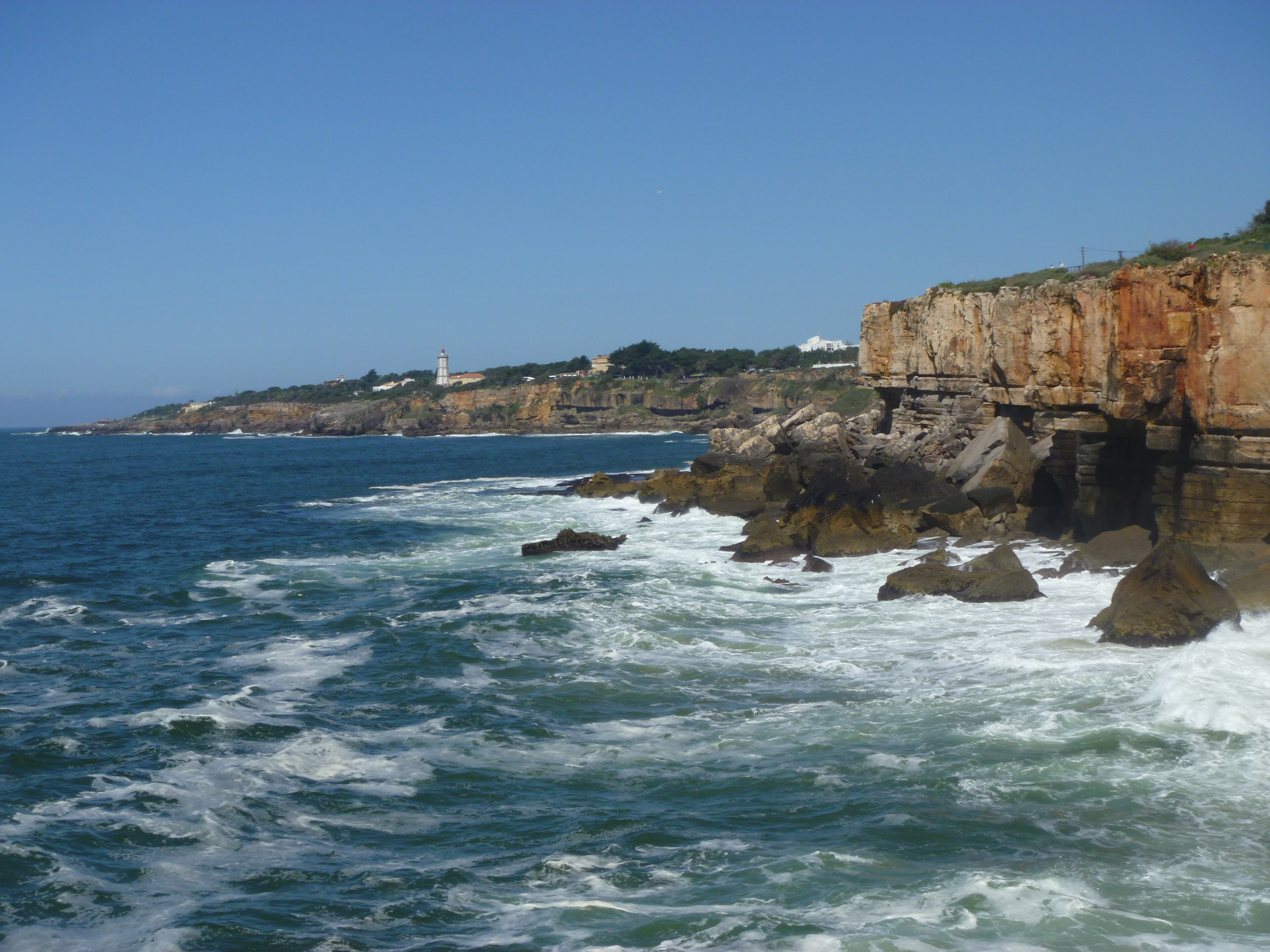
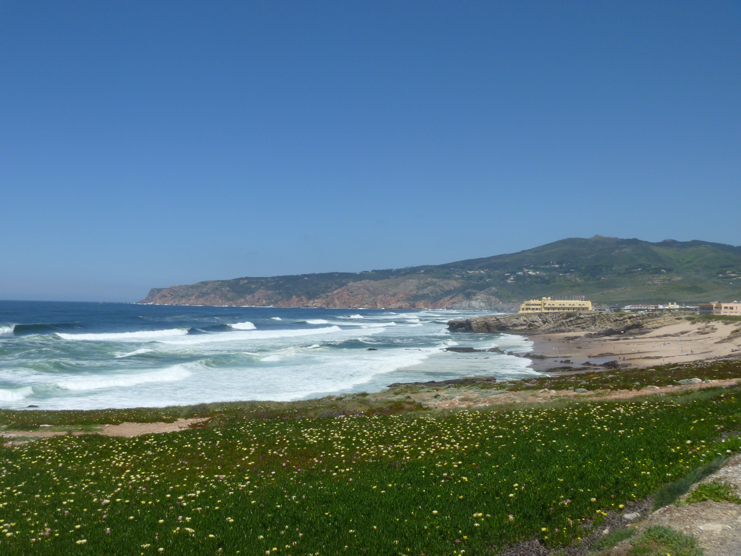
The Southwest Coastal Path national trail passes along the coast here and we couldn’t resist joining it for a while to get a view of the Castle Bungalow in its setting and, of course, just sit on a quiet bench and contemplate the sea and the sky and peaceful scene in front of us.  In the other direction, beyond the bungalow, the path heads towards nearby picture-postcard Clovelly.

CB in position

Castle Bungalow and the sea from the SW Path bench

I spent just one night as a guest at Bridge Cottage … I hope the Christmas Landmarkers will bring fairy lights for the windows!

Cape Cod : Woods Hole and Martha’s Vineyard and More

Beach at Falmouth

The Beach at Falmouth

It’s time to re-visit my summer holiday and go right back to the first week and a half that we spent on Cape Cod. We had marvellous weather and it’s strange to us but after Labor Day (the first Monday in September) many places close down and the locals more or less have the place to themselves again. It’s the way we like it. The weather is still good but you can find a table at a restaurant without queuing, the roads and beaches are almost empty but most of the local shops are still open.

Estuary Fairhaven

The Estuary at Fairhaven

We don’t usually travel far from our digs but we always make one excursion out of our Cape Cod Comfort Zone and that is to visit my online book group friend sherry who lives in Marion, Massachusetts on the other side of Buzzards Bay. This time our excursion included a new activity as my husband has taken up sailing and as it was impossible for us to find a sailing school open on the Cape he signed up for 16 hours tuition over two days (and including a one hour written exam at the end) at Sail Buzzards Bay  (Fair Winds and We’ll See You on the Water!) based in Fairhaven, Mass. just a few miles from Marion.

101 Main St Fairhaven

Sail Buzzards Bay HQ, Main Street, Fairhaven

Preparation for sailing

Preparation for Sailing School

Needless to say the watery theme continued throughout the trip. One day we took the ferry to nearby Martha’s Vineyard. The ferry from Falmouth to Oak Bluffs on the Vineyard takes just 35 minutes and during the autumn season there are just two sailings in each direction each day (Monday to Thursday – more sailings at the weekend). We understood that it was worth taking the bus to Edgartown where we had lunch, watched the three vehicle five minute journey Chappaquidick Ferry and had a wander around the compact centre of town.

Main St Edgartown

The Main Street, Edgartown, MV

Here’s how the tourist leaflet describes Edgartown :

“One of New England’s most elegant communities, Edgartown was the Island’s first colonial settlement and it has been the county seat since 1642. The stately white Greek Revival houses built by the whaling captains have been carefully maintained. They make the town a museum-piece community, a seaport village preserved from the early 19th century.”

Chappaquidick Ferry

The Tiny Chappaquidick Ferry

Daniel Fisher House

The Grand Daniel Fisher House (1840)

I’d hoped to visit the Whaling Church but it was included on an organised tour from the museum (which also included a visit to Daniel Fisher House) and we just didn’t have time before taking the bus back to Oak Bluffs for our return to the mainland.

MV Museum

The Very Old Vincent House Museum

Whaling Church Edgartown

The Impressive Whaling Church

On several days we would drive down to Woods Hole the village attached to the extensive Woods Hole Oceanographic Institute that dominates the area. There are some good seafood restaurants with docks onto the marina – all very nautical.

Woods Hole Marina


Dining at Woods Hole Marina

We also called in to see the displays at the WHOI Visitor Centre. The main exhibition highlight is the 1985-1986 discovery and exploration of the wreck of the Titanic.

Titanic 1


Titanic 2


Titanic 3

“This 1/570 scale model of the Titanic stern is on loan to WHOI from Roy Mengot of Plano, TX. Roy’s model is based on WHOI data and imagery and is among the best representations of the Titanic wreck as it was found during the 1985 and 1986 WHOI expeditions. The completed bow and stern models took 3,000 hours to build.”

Titanic 4

In addition to the Oceanographic Institute Woods Hole is also home to The Marine Biological Laboratory (MBL), The National Marine Fisheries Service, the Sea Education Association, The United States Geological Survey and the Woods Hole Research Center. Wow! That’s home to a lot of eggheads.

There’s a memorial statue to Rachel Carson author the far-reaching text “The Silent Spring”.

“I had my first prolonged contact with the sea at Woods Hole. I never tired of watching the tidal currents pouring through the Hole – that wonderful place of whirlpools, and eddies and swiftly racing water” Rachel Carson, author of  The Sea Around Us; The Edge of the Sea; Under the Sea Wind; Silent Spring. Scientist, writer and colleague at MBL, NOAA and WHOI 1907-1964

Rachel Carson on the hot seat

Rachel Carson on the hot seat!

Finally, I still haven’t got round to reading it but maybe I should read this first :

Moby Dick Book


Overstrand : Narrow shore with a steep edge

Beach at Overstrand

Sea-Marge

Pebbles are beneath, but we stand softly
On them, as on sand, and watch the lacy edge
of the swift sea.

Which patterns and with glorious music the
Sands and round stones — It talks ever
Of new patterns.

And by the cliff-edge, there, the oakwood throws
A shadow deeper to watch what new thing
Happens at the marge.

Ivor Gurney, Selected Poems (edited by George Walter) (J. M. Dent 1996).

I came across this poem last March whilst staying in Tewkesbury. Until then I had wondered about the name of the hotel in Overstrand, north Norfolk, where I had booked to stay a couple of nights last week.

Despite growing up in Norwich just 22 miles south of Overstrand I had never actually visited this neighbouring resort of Cromer.

Overstrand lies on the North Norfolk coast between Cromer and Sidestrand. It’s name derives from ‘narrow shore with a steep edge’. There is a nice walk along the cliff-top path from Cromer which passes the old lighthouse and the golf course. Like it’s larger neighbour, it was once a genteel Edwardian holiday destination – but today has an air of faded grandeur.

Lord and Lady Battersea had a holiday home called The Pleasaunce built here in 1897. It was designed for them by Sir Edwin Lutyens and hosted a number of literary visitors including Arthur Conan Doyle and George Meredith.

Winston Churchill used to stay at the Sea Marge Hotel in the village and this may have provided the inspiration for Jack Higgins’ novel The Eagle Has Landed – which is set in North Norfolk (see Blakeney) and concerns an attempt by German paratroopers to assassinate the English PM. While in residence Churchill had elaborate arrangements in place with Cromer Post Office in case the grand fleet needed mobilising.” Source

The Sea Marge

The Sea Marge Hotel, Overstrand

Sea Marge front

Sea Marge Front

Sea View

Sea View from The Sea Marge

Sea Marge Lounge

The Sea Marge Lounge

Sea Marge Gallery

Gallery overlooking the bar at The Sea Marge

Winston Room

Sir Winston Churchill above the Fireplace in the Winston Room

Pleasaunce front

Pleasuance (now a Christian Retreat and Holiday Centre) Front

Pleasuance entrance

Pleasuance Side Entrance

Side entrance Pleasuance

Pleasuance Entrance

Lutyens church

The Methodist Church at Overstrand designed by Sir Edwin Lutyens

Church door

The Church Door

Watery North Devon Literary Connections

There are some watery literary connections in North Devon. Charles Kingsley author of The Water Babies lived in Clovelly as a child and returned many times as an adult and Henry Williamson lived for some time in Georgeham near Croyde and based his Tarka the Otter stories on local North Devon rivers.

Charles Kingsley was born at Holne Vicarage on Dartmoor. I visited the church, but the vicarage was inaccessible, a couple of years ago when staying in the area. Here is a brief resumé of his life and a picture of the stained glass window in the church of St Mary the Virgin at Holne.

life of Charles Kingsley

Church at Holne

St Mary the Virgin, Holne, Dartmoor

Stained glass window

Charles Kingsley Window, Holne

There is a Charles Kingsley Museum in Providence House (his former home) in Clovelly. The Kingsley family moved to Clovelly from Holne when Charles was 11 and they lived there for six years. Charles Kingsley visited the village frequently as an adult and wrote his novel “Westward Ho!” here.

Providence House Clovelly

Providence House, now The Charles Kingsley Museum, Clovelly

Step inside the Museum with me and see Charles Kingsley at work in his study and his chair and his Christening Shawl.

CK and his christening shawl

Charles Kingsley and his Christening Shawl

CK's chair

Charles Kingsley’s Chair (on loan from the parish of Eversley, Hampshire)

The leaflet supplied to visitors states that “the village also inspired him to write ‘The Water Babies’. I had always understood that Kingsley was inspired to write the book on his visits to Yorkshire whilst staying near Malham Tarn at a house called Bridge End in nearby Arncliffe in Littondale. Here is an article from The Yorkshire Post supporting this fact. Maybe he was also inspired by Clovelly on some aspect of the book?

Tarka the Otter

From a wet and windy Clovelly I headed to Braunton for fish and chips and then to the local museum. I expected to find some information about local writer Henry Williamson who wrote ‘Tarka the Otter’. There was a small display about the author who wrote many more books than this famous nature writing including :

The great work of his mature years, A Chronicle of Ancient Sunlight, [which] stands as a true statement of the social history of this country in all its varied detail, through the life of the main character, Philip Maddison.”

In north Devon it’s Tarka, Tarka everything. The Tarka Line (railway), The Tarka Trail (walking/cycling path), Tarka Holiday Parks (caravans), Tarka Radio (hospital radio) the list is never-ending. But finding places relating to the otter’s author takes a bit more research. The Henry Williamson Society have managed to secure a couple of blue plaques on his two homes in nearby Georgeham and his writing hut still stands in a garden at nearby Ox’s Cross. Through pelting rain I managed to snap the two Georgeham homes and Williamson’s grave but I had to forego finding the shed.

Hut

Henry Williamson’s hut at Ox’s Cross

Williamson Skirr Cottage

Williamson’s first home in Georgeham : Skirr Cottage [named after the sound made by the wings of owls on the roof]

Skirr Cottage plaque

Crowberry Cottage

Crowberry Cottage – Williamson’s other home in Georgeham

Crowberry plaque

Read here about a journalist’s search for The Field and other Tarka and Williamson locations.

Williamson grave

Crowdless Clovelly

Clovelly info board

The famous and picturesque village of Clovelly on the North Devon coast is quite unique. Its streets are too steep for cars and in the past donkeys were used as the main form of transport. Donkeys are still kept at Clovelly but no longer used for heavy loads. Instead these days all goods are transported by sledge.

Clovelly Sledge transportation

Clovelly Sledge Transport

There is a huge car park at the top of the village and you enter Clovelly through the big visitor centre containing a ticket office  (yes, there’s a £6.50 charge to park and visit the village) and a shop selling everything from postcards and books of all kinds to sweets and souvenirs, a cafe and an audio-visual film show. The village is owned by one family – read more about the history of the village ownership here.

Looking up cobbled street Clovelly

The main street in Clovelly

Down the main street in Clovelly

I suppose the poor weather meant that the usual Clovelly crowds kept away and I had the village practically to myself. There was a small coach party of German tourists arriving at the same time as me but we soon spread out in the narrow streets and passages and shops and inns and around the harbour so my visit was not in any way spoiled by the famous crowds that I had heard of.

Clovelly Quay

The tide’s out at the quay

I decided to walk steadily down the main street and sit down for a while on the 14thC quay to study the map (so long as it stayed dry) and work my way slowly back to Hobby Drive and from there regain the car park.

The tide is out at Clovelly Harbour

Clovelly and Lifeboat Station

Down at the harbour the tide was out but it looked as if there is still some kind of fishing industry being carried out here. The map and leaflet list all the places to see and I managed see/visit them all.

Crazy Kate's Cottage Clovelly

Crazy Kate’s Cottage [The oldest cottage in Clovelly, named after a fisherman’s widow]

Temple Bar Cottage Clovelly

Temple Bar Cottage [here the street passes under the kitchen and dining room of a cottage]

Oberammergau Cottage Clovelly

Oberammergau Cottage [decorated with wood carvings from Germany]

Clovelly Museum and signs

Kingsley Museum and Shop [find out more about Charles Kingsley and his times in Clovelly]

Rex Whistler's Clovelly poster

Rex Whistler’s ‘Clovelly’ toile de jouy fabric in the museum

Toile de Jouy

Close-up of the fabric

Exterior 15th century fisherman's cottage

Fisherman’s Cottage [see how a fisherman lived in the 1930s]

Queen Victoria Fountain

Queen Victoria Fountain [a stone fountain built as a monument to Queen Victoria]

Mount Pleasant Clovelly

Mount Pleasant [a grassy picnic spot with war memorial and spectacular views]

Hobby Drive poster

Hobby Drive Poster

Hobby Drive Walk info

Hobby Drive Walk

Bay from Hobby drive

Bideford Bay from Hobby Drive

Rain was threatening on the morning of my visit but it held off until I’d JUST begun my Hobby Drive walk. Then the heavens opened and reluctantly I gave up the walk and headed off to Braunton and shelter and sustenance at Squires fish and chip restaurant.

Cabo da Roca or Promontorium Magnum : The Edge of the World

The highlight of the next day’s walking was to visit the Cabo Do Roca – the westernmost point of the European mainland. Called Promontorium Magnum by the Romans and before the Age of the Explorers was thought to be the Edge of the World.

Cabo da Roca sign

But before heading off on the next sector of our walk we spent a relaxing morning at The Sao Saturnino. Breakfast isn’t served until after 9am and we also wanted to wander around the maze of buildings and the gardens. Here are some pictures of this beautiful location.

Entrance Saturnino

Sao Saturnino Entrance

Saturnino library

Sao Saturnino Library

Convento sea views

Sea Views from The Sao Saturnino

Leaving the C da SS

Leaving The Convento da Sao Saturnino

So, late morning we headed off from the Convento, through the village of Azoia, to the Cabo da Roca. “The phrase that is most attached to this outcrop is ‘where the land ends and the sea begins’ which was coined by Luis de Camoes, the 16th century Portuguese poet.” [Route Brochure].

Approaching Cabo da Roca

Approaching the Cabo da Roca

Cabo da Roca

Cabo da Roca

Cabo de Roca Monument

The Monument at Cabo da Roca

Cabo da Roca sign

What it says on the Monument

The Atlantic Ocean at Cabo da Roca

The Atlantic Ocean at Cabo da Roca

The Lighthouse at Cabo da Roca

The Lighthouse at Cabo da Roca

The lighthouse was built in 1772 and stands 144 metres above the cape which itself stands 140 metres above sea level.

Our paths continued, with some diversions due to the January storms, mostly along the coastline to the famous Praia Grande. PG is one of the largest stretches of sandy beach on the Portuguese coast. The name means Big Beach and is extremely popular  with surfers all year round. Our hotel was perfectly situated right on the beach and our room overlooked the pounding waves and the hotel’s huge 100 metre swimming pool.

Arribas Hotel

Along the Way – Forts

As you will have seen our first day’s walk was not too long and followed the Portuguese coastline from Cascais to Guincho. On the first day the walking distance is always a bit shorter than most others because it is your opportunity to meet with the Route Manager and discuss the route, any last minute changes and exchange mobile ‘phone numbers.

Santa Marta Lighthouse, Cascais

The Santa Marta Lighthouse near Cascais

We spent a sunny Sunday morning in a park with Ana, our manager, as there was a big 10k race going on right outside our hotel meaning that access was made rather difficult. Ana had to explain to us that very severe storms last January had caused much damage along the route and some of the paths were now impassable. She had done her homework though, and walked the whole length trying to re-jig the route in just a couple of places. Luckily she was also  on the end of the ‘phone when we needed a bit of clarification on a couple of days.

Boca do Inferno 1

Boca do Inferno

Boca do Inferno 2

Boca do Inferno

Boca do Inferno 3

Boca do Inferno and Guia Lighthouse

Our route that morning was busy and ran parallel with the coast road. Lots of walkers, families, joggers and cyclists shared the route with us. We passed lighthouses and dramatic coastal features and were able to take a brief break at The Forte de Sao Jorge de Oitavos. Not far from Cascais is the Boca do Inferno or Hell’s Mouth. “This is a natural chasm and the sea water has access to the very bottom of the chasm so when the sea is unsettled the effect is quite impressive!” [From our Route Booklet] Even when the sea is pretty calm the effect is still pretty impressive! There is a  viewing area just down from the path.

Forte St Jorge

Cabo Roso Lighthouse

The Cabo Roso Lighthouse

Probably about midway between Cascais and Guincho is the The Forte de Sao Jorge de Oitavos. It’s a handy visitor’s centre along the coast and has exhibitions and displays as well as a sheltered courtyard out of the wind. It was built as a defensive fortification against possible landings by pirates or invaders between 1642 and 1648.

Approaching the Fortaleza

Approaching the Fortaleza [yellow building]

The shortish walk meant that we arrived at our most luxurious hotel The Fortaleza do Guincho in the early afternoon giving us plenty of time to relax and read enjoy a late lunch and later an afternoon tea on the sunny terrace overlooking the dramatic waves and nearby beaches followed by a bar meal dinner in the sumptuous lounge area. We needed this rest and recuperation after the long day of travelling the day before and the next day’s walk – the longest of the trip.

Afternoon Tea at the Fortaleza

The much-appreciated Afternoon Tea at The Fortaleza

The Best Way to See the World is on Foot! Sintra and The Portuguese Coast Footloose Holiday

ATG bus

In June last year my sister and I took our first ATG Footloose Holiday in Alsace. We were so impressed with the organisation and our own walking ability that we decided to book an even longer trip this year. We spent last week in Portugal doing the Sintra and Portuguese Footloose Walk.

Here is the text of the itinerary!

Cascais sea front

Cascais Beach and Sea Front

“Day 1 • Arrive in Cascais. A fashionable resort with a marina, smart shops, elegant restaurants and one of the best (and cleanest!) surfing beaches in Europe.”

Boca do Inferno

Boca do Inferno [Mouth of Hell] (between Cascais and Guincho)

Day 2 • Cascais to Guincho. An outstanding walk along the coast, passing lighthouses and fascinating cliff formations with dramatic coastal views, to Guincho Beach, one of Portugal’s best windsurfing locations (6.5 miles, 3.5 hrs).”

View from Peninha

View from Peninha

Day 3 • Guincho to Azoia. Follow coastal paths before heading inland into the Serra de Sintra. Opportunity to visit the interesting Convento dos Capuchos (Capuchin monastery) (+2 hrs), before returning through the Serra up to the spectacularly situated 14th century Peninha Chapel. Paths then lead down to your hotel near the coast (4.9 or 11.7 miles, 3 or 6 hrs).”

Cabo da Roca

Day 4 • Azoia to Praia Grande. A cliff-top walk with spectacular views leads to Cabo (Cape) da Roca, the most westerly point of Portugal – and mainland Europe. Continue inland through the vineyards of the famous ‘Colares’ wine before returning to the coast and past dramatic cliff formations to the beach of Praia Grande, with its world- famous swirling waves (7.2 miles, 4 hrs).”

Azenhas do Mar

Azenhas do Mar

Mamede

The Church of Sao Mamede

Day 5 • Praia Grande to Colares. Continue along the coast to the small seaside resort of Azenhas do Mar, with its pretty whitewashed houses perched on a cliff. From here the coastal path continues, past more fine beaches, then heads inland to the curious church of São Mamede, ‘protector of the animals,’ which were freely allowed to enter the chapel until recent times. Minor roads then lead to Colares, famous for its wine (6.9 or 9.9 miles, 3 or 4.5 hrs).”

Monserrate

Monserrate Palace and Gardens

Day 6 • Colares to Sintra. Walk through small hamlets and vineyards before joining wide forest paths passing through the Serra to the ‘Romantic’ Palace of Monserrate, with exotic gardens and follies. Continue through the Serra and a short section of road brings you to the arch of the old west entrance to Sintra (6.9 miles, 3.5 hrs).”

Sintra from the Moorish Castle

Sintra from the Moorish Castle

Day 7 • Free day in Sintra. Described by Byron as a ‘glorious Eden’, and boasting UNESCO World Heritage status, Sintra is a visitor’s paradise, with magnificent palaces, gardens, galleries, churches, museums, and cobbled, medieval streets lined with boutique shops and cafés.”

Ana at Lawrence's Hotel, Sintra

Ana Our Lovely Five Star Tour Manager at Lawrence’s Hotel, Sintra

Agatha Christie at Home and at Hotels

It was great news when The National Trust announced in 2000 that they had received the gift of Greenway to add to their inventory, although the house did not open to the public until 2009. Being a regular visitor to Devon I made particular point of arranging a visit to Greenways on 22nd August that year. I’d seen the house, perched above the River Dart, several times from river excursion boats and apparently travelling by river boat (The Green Way) is the best way to approach it.

But I had my elderly mother in tow so we booked a car parking space and a table in the restaurant (converted from Agatha’s own kitchen). The gardens are beautiful and varied and paths lead up above the house to the kitchen garden and down to the River Dart and the Greenway Boat House.

Greenway Boat House from the River Dart: featured in Agatha Christie’s ‘Dead Man’s Folly’.

The Greenway Boat House (above and below)

Agatha Christie used the boathouse as the location for the fictional murder of Marlene Tucker in ‘Dead Man’s Folly’

We made a tour of the house with an introduction by a room steward and were then left to our own devices. I don’t have any interior photos so we were probably asked not to take any. My question to the guide was “Which books did Agatha actually write here?”. The answer was “None”. She used the house as a summer retreat and invited guests of friends and family to join her. Here she would read her latest manuscript to these guests in the evenings before publication in the following autumn. However, one book was written based entirely around the Greenway location : “Dead Man’s Folly“. I read loads of Christie novels in my late teens but have never gone back to them since. With the exception of DMF which I bought secondhand the day after visiting the house and read straightaway. All the locations came back to me with immediate clarity. The boat house featured as the location where the murder took place.

Greenway Library – my favourite room (Photo from Agatha Christie at Home by Hilary Macaskill)

[The frieze was painted by Lieutenant Marshall Lee when he was stationed at Greenway by the US Navy. The house had been requisitioned by the Admiralty during the Second World War.]

After our house tour we used the servants’ entrance to the dining room where only 3 or 4 tables were set for lunch. We enjoyed our meal surrounded by Agatha Christie’s cookery books and kitchen equipment.

Moorlands Hotel

Interestingly, I have come across two hotels with Agatha Christie connections within just a couple of weeks. The first is Moorlands near Haytor just on the edge of Dartmoor. Whilst staying here Agatha Christie was inspired to write her first book, The Mysterious Affair at Styles.

Moorlands is now a hotel belonging to the HF Holidays organization and it was just steps away from our cottage on Dartmoor in October. There’s a lovely cafe (with wifi) – Dandelions – which is open to non-residents. I already knew about the Christie connection and asked to see the picture.

Agatha Christie Portrait and Complete Works

Then this weekend I visited a friend who was staying at The Old Swan Hotel in Harrogate. This was the hotel where AC was found 10 days after she mysteriously disappeared following her husband’s revelation that he was leaving her for another woman.

And finally, what do Agatha Christie, The Duke and Duchess of Windsor and Edith Wharton (all featured in these pages) have in common? Answer : they all had doggie cemeteries for their own pets.

Overbecks to Bolt Head : a Devon Coastal Walk

Each year at this time when we visit Devon we spend an afternoon having the cobwebs blown away by walking from Overbecks to Bolt Head by coastal path and returning on a higher path a total walk of only 4 or 5 miles but sufficient to enjoy different coastal views and work up an appetite for dinner! We are on holiday after all.

Back in 1972 my husband, The Optimist, spent one heavenly summer working as the male assistant warden at Salcombe Youth Hostel. It was  obviously a fantastic experience for him and he has relived it ever since, so much so that I now feel as if I worked there too. Besides the work itself which was fairly mundane, he enjoyed snorkelling and swimming and diving and generally messing about in boats and the sea through one long warm sunny summer … yes, those were the days! I don’t think a single drop of rain fell on South Devon that summer. I must say, that having seen this Youth Hostel, I do think it is located in one of the most idyllic locations imaginable.

The Tower Bedroom – reserved for the male assistant warden

So, as I say, each year when we spend a week in October/November in Devon we make an excursion to the Salcombe area and in particular to the National Trust estate of Overbecks Sharpitor. The gardens stretch steeply down the cliff face from the house and the influence of the local microclimate has lead to a singular garden of luscious tropical vegetation.

A hidden paradise of subtropical gardens and eclectic collections…
An exotic and fascinating hidden treasure perched high on the cliffs above Salcombe. Explore the banana garden, meander through the woodland, or relax beneath the palms. Walk along the coast path and soak up the spectacular panorama across miles of beautiful coastline and estuary.”

So, walk along the coast path and soak up the panorama we did. A few paces down from the Overbecks car park there is a sign inviting one to join the footpath to Starehole Bay. This clearly defined path clings to the cliff face and in each direction are wonderful views down the ria (a tidal inlet with no major fresh water source flowing through it) to Salcombe or out, over the bar :

This shallow sandbank, evoked by Tennyson in his poem ‘Crossing the Bar’, lies across the ria’s mouth and is barely 60cm (23 inches) below water on an ebb tide. Devon’s worst life boat loss occurred here on 22 October 1916, when the ‘William & Emma’ capsized rowing back from a rescue.” (NT Website)

to the English Channel.

Salcombe and Ria from the lower footpath

Salcombe and the Ria from The South West Coastal Path

The path is dotted with handily placed seats upon which one may rest and enjoy the view but last Friday there was a misty rain blowing so we tended to keep walking.

Official Long Distance Footpaths are indicated by an Acorn on the sign posts

Starehole Bay from the NT site :

“On calm days you’ll see the dark patch of seaweed beneath the north waters of the cove, marking the Hezogin Cecile wreck. This grain clipper ran aground off Soar Mill Cove on 24 April 1936. For seven weeks the ship lay stranded whilst sightseers in their thousands lined the cliffs, holding their noses from the stench of rotting wheat. The ship was smashed in a July gale after being towed to Starehole Bay.”

From Starehole Bay there is a steep a path up to Bolt Head and from there it’s possible to join the SouthWest Coast Path and return to Overbecks along the cliff top.

Starehole Bay

Bolt Head from the NT site :

People have been farming at Bolt Head for centuries and the cliffs are dotted with the remains of field boundaries and animal enclosures, some dating back to the Bronze Age. Today, Dartmoor ponies graze on the cliffs, preventing blackthorn and gorse from smothering the slopes. Look out for grey bush crickets and their great green cousins (the largest in the British Isles). Fulmars, gulls, cormorants and shags bred on the cliff-faces. The headland was the site of a Second World War lookout until it was demolished in 2007, and is also a stop over for migrating swallows and house martins.”

Funnily we didn’t see a Dartmoor pony on Dartmoor this year – just  cattle. We did see the cliff top grazing ponies at Bolt Head, though.

The cliff top path descends again into Starehole Bay before climbing up again for the final mile and a half or so back to Overbecks. There’s a tempting sign very strategically placed to encourage one into the tea shop (also the Youth Hostel dining room) but we had a table booked for dinner so didn’t linger for refreshments on this occasion.

Time for a Cuppa?

Final view of Overbecks and Salcombe from the SW Coastal Path