
A walk along the Hasliberger Dorfweg (Hasliberg village trail) is like a 1960s geography lesson brought to life. Just as I did yesterday, I took the crowded cable car from Meiringen/Alpbach to Reuti at one end of the trail. In school we learnt how to draw a Swiss chalet and the practicality of the design. We learned about transhumance and how self-sufficient each farm needed to be and about diversification. In physical geography we studied glaciers and valley shapes and the importance of communication routes. The evidence is all to be found on this walk.
Years ago I came across a leaflet in English outlining this walk and describing certain historic buildings along the route. It’s called Hasliberg Houses and I had hoped one day to do the walk … and today was that day.

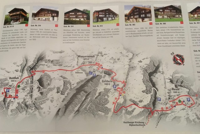
I picked up the latest German edition “Hasliberger Dorfweg” from the tourist office at Meiringen Station this morning.

The trail curves around the village of Reuti following the tarmac paths that are just wide enough to take a single car; but then only for access.

The Eiger Glacier
In former times the animals were kept on the ground floor so that the heat would rise to warm the house. Additional heat was from a tiled stove in the corner of the main room – fed by logs from the surrounding woods. Still today each chalet has immense log piles stacked up to the eaves but the farm animals no longer share residence with the family.
On past visits to the Ballenberg Swiss Open-Air Museum I’ve been amazed at the variety of chalet types that exist in this small country. It seems each Canton or county has an individual style of its own. Chalet examples of all kinds have been uplifted and transported to be re-erected in the Museum. It strikes me that the Bernese chalet is the textbook version.
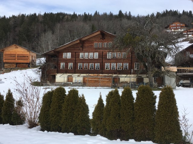
A fine example of a Bernese Swiss Chalet (18th century).


Many farmers and small-holdings sell their produce – cheese, butter, honey – directly to the public.

Monika and Peter make every effort to please their customers

And ready-made fondue mix sold here


Many of these older chalets also have beautiful barns attached or free-standing nearby

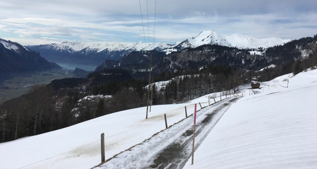
It was a surprise to me that the marked trail was not entirely along the small tarmac or prepared paths but continued uphill through snow-covered meadows.
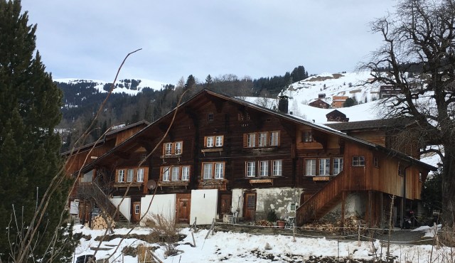
Another textbook chalet
Many of the modern buildings, here mostly built to the basic chalet design, are holiday or second homes and many of the older chalets, no longer housing several generations under one roof, let self-contained apartments. I noticed that there were hardly any signs saying Zimmer Frei (Room to let) as there used to be decades ago. Now it’s ‘Wohnung zu Vermieten’ (Apartment to let).
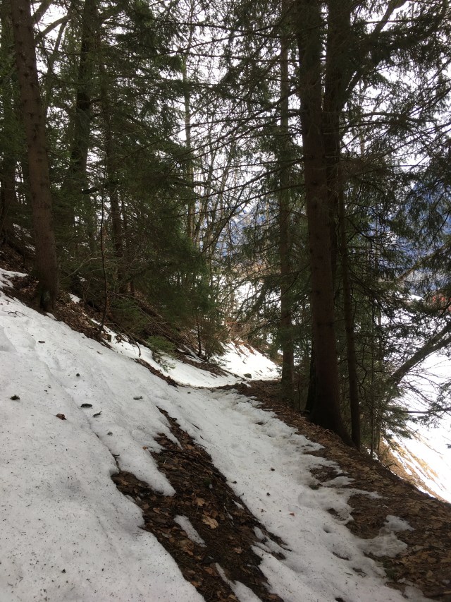
In places the track passed through woodland
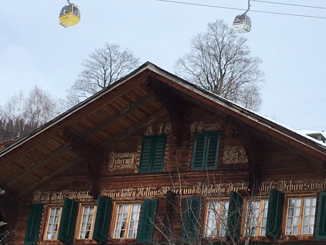
Beautifully decorated with some saying or family description. Above the roof is another sign of sport and tourism bringing hard cash to the region.
For the final part of the trail I repeated the last section of yesterday’s walk.
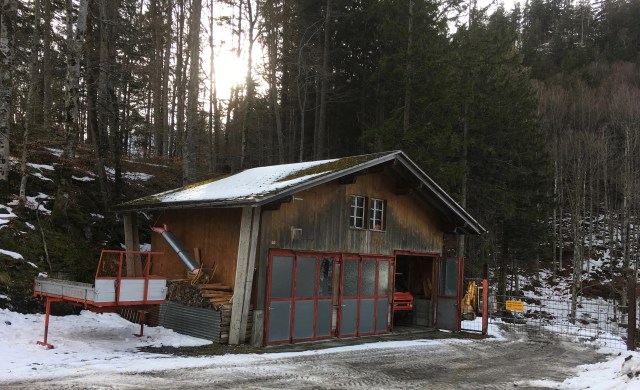
Here’s one of the smaller timber sawmills of which there are several on Hasliberg
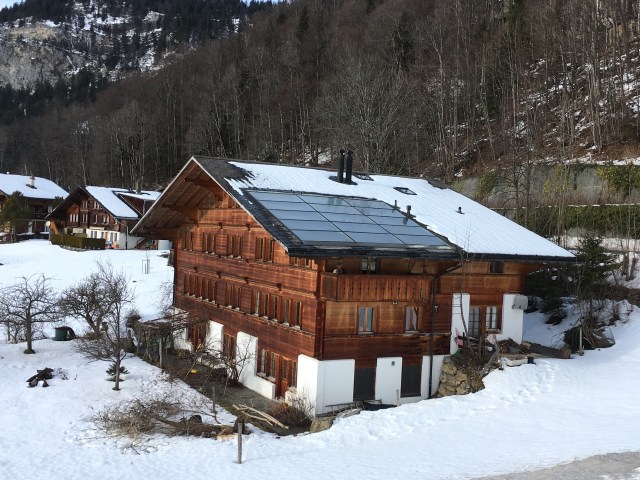
Instead of the stones we used to draw on the roofs of chalets (for protection against the hard winter weather) today’s chalets are kitted out with solar panels
The 6 mile trail finishes in Hohfluh from where I caught the Postbus to Brünig Station and train back to Meiringen.


How easy was it walking through the snow?
It wasn’t at all easy. Especially uphill. But I still pressed on. British perseverance.