Walking in East Sussex

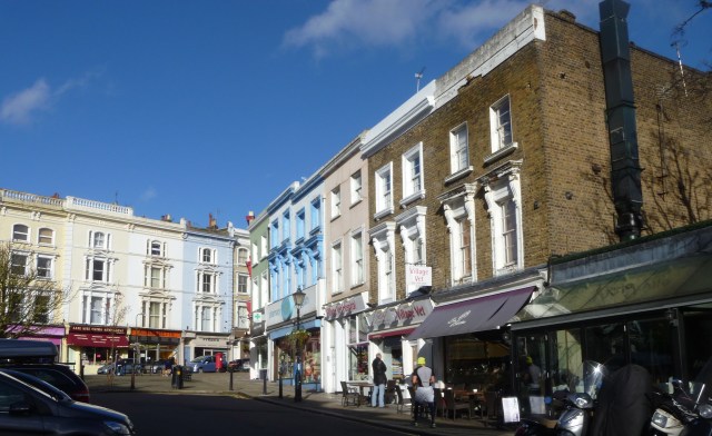
The main aim of my stay in Sussex was to meet up with two Swiss friends. Last year when I was staying with Barbara in Bern for the weekend the idea of visiting Charleston and all those ‘Bloomsbury’ related places in Sussex was suggested. I said I’d also wanted to visit them and showed Barbara the Landmark Trust website. When she saw Laughton Place tower she would not be budged to look elsewhere for accommodation. So we ended up last weekend in the tower and visiting as many Bloomsbury locations as we could manage.

Alfriston Church

Alfriston Church and Village Sign

Badgers

Badgers Alfriston (Note the Boot Bags – it’s on the route of the South Downs Way)

Barbara and Kathryn first wanted to have a few days in London so I spent the first two nights at Laughton Place on my own. But for the most part I wasn’t alone thanks to Fran being able to spend Tuesday afternoon and all day Wednesday with me.

Seven Sisters Info

Knowing my love of hiking she had planned a walking expedition for us but the weather was not kind on the Wednesday morning so we took lunch in Alfriston and drove later in the afternoon to the Seven Sisters Country Park car park, donned our boots and set off on a shorter walk following the River Cuckmere to where it joins the English Channel. At the sea’s edge you have a wonderful view of The Seven Sisters cliffs over which we might have walked part of the South Downs Way had the morning’s weather been different.

Seven Sisters

The Seven Sisters (looking east)

Looking west at 7 sisters

Looking west

Sign and River

River Cuckmere behind the Footpath Signpost

River Cuckmere

River Cuckmere with Ox Bow Lakes, Meanders and the English Channel

Meanders and Buttercups

Meanders and Buttercups

Thank you, Fran, for your good company and for being the most informative guide possible!

Firle

The Village of Firle nestled below the South Downs

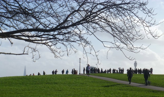
On Sunday Barbara, Kathryn and I drove to the car park above the village of Firle and walked a mile or so each way to Firle Beacon and back. At the Beacon (an Ordnance Survey Triangulation Point) we could see the Channel and a cross-channel ferry arriving at Newhaven in one direction and the flat levels and meadows that surround Laughton Place in the other. There right in front of us but a little distant was our Tower itself.

On South Downs

Sunday Morning on the South Downs

After our walk we headed down into Firle village. Vanessa Bell and Duncan Grant (see future posts about ‘Bloomsbury-on-Sea) are buried in the churchyard; Virginia and Leonard Woolf had a house in Firle before they moved to Monk’s House and we had a drink in the warm sunshine at The Ram Inn.

Firle churchyard

Firle Churchyard : Graves of Duncan Grant and Vanessa Bell

LT Firle

Little Talland

Little Talland House, Firle

I also managed to fit in a short walk directly from the Tower towards Laughton village but I never quite made it. I was anxious to see the village but had the time constraint of meeting the London train too so after a mile or so I turned back and drove to Laughton (the village of the buckle).

Bridge Stile

Complicated Bridge/Stile near Laughton Place

LP from footpath

Laughton Place in its Landscape

Acquapendente to Bolsena and Bolsena to Orvieto

Day 6

Free day in Bolsena: Explore Bolsena, its ancient streets, castle, Etruscan temples and church, and catacombs of Santa Cristina, site of the miracle of Corpus Christi. Swimming in the lake. Optional walk from Acquapendente through the low Monti Volsinii (12.2 miles, 6 hours).

Bolsena

Bolsena comes into view as we complete our walk from Acquapendente

Being gluttons for punishment of course we’d decided all along on the optional walk from Acquapendente. Lucky for us that Tuesday morning had been assigned by Annalisa as our ‘feedback’ time for the trip. So, as previously arranged, we met Annalisa in the hotel lobby and gave our views on the walks and hotels, restaurants etc. This slightly delayed our departure so A, whose home is in Acquapendente, offered us a lift to the start of the walk advising on places to buy lunch and water for the day. We bid her a very fond farewell as she drove off to her next assignment.

Farewell Annalisa

Goodbye Annalisa and Thank you! – Keep Smiling! You’re doing a great job!

Day 7

Bolsena to Orvieto: An old Etruscan lane leads up through woods to a plateau and across farmland. The first view of Orvieto, situated high on its extinct volcano, is unforgettable (11.3 miles, 5.5 hours). Don’t miss the magnificent cathedral with frescoes.

Wednesday, the final day of our journey to Orvieto, the weather was back to its usual blue sky and sunshine. We walked up through the old town of Bolsena and up out of the crater following a paved Roman Road and an Etruscan Lane. We were told that the route follows the historic trail of the procession of the Miracle of Bolsena.

Lake Bolsena last morning

Lake Bolsena as we leave the town

Bolsena 1

Historic Bolsena

Bolsena 2

Old Bolsena

La Medusa  Shop

La Medusa Shop – Maker of Replica Roman/Etruscan Artefacts??

La Medusa

La Medusa

Bolsena rooftops

The Rooftops and Lake – Bolsena

Bolsena Castle

Bolsena Castle

Leaving the town we soon turned from the tarmac road onto a long ancient track. “You are now walking on the old paved Roman Road to Orvieto with the flagstones clearly visible underfoot” declared the Route Booklet. I think possibly our route diverted quite a bit from the typical Roman straight-line road but we certainly approached Orvieto downhill and then uphill in a straight line.

Roman Road

The Roman Road leaving Bolsena

Ronman Road 2

Flagstones clearly visible underfoot

We crossed the border from Lazio into Umbria (Bolsena and Acquapendente are both in Lazio we left Tuscany behind between San Quirico and Latera on Monday). A couple of kilometres later we visited our final 9 Etruscan tombs. They appeared rather abandoned and the Information Board had been stripped of all information. About 5 km from our hotel in Orvieto we had our first view of the city perched on its extinct volcanic rock.

Some of 9 Etruscan tombs

Some of the 9 Etruscan Tombs

First view of Orvieto

Our first view of Orvieto

We made it! We arrived at our hotel in Orvieto with a great feeling of satisfaction and achievement. Our last night was spent in Orvieto but although the ATG holiday finished with breakfast the next day we were to travel on to Rome for a further night before returning to Yorkshire on Friday.

Orvieto Cathedral 1

The Orvieto Duomo or Cathedral at night

Orvieto Cathedral day

Begun in 1290 it is probably the finest example of Romanesque Gothic in Italy – The Duomo by day

Like our achievement – Magnificent!!


Sovana to Bolsena – Tracks and Tombs and Troglodytes … and Rain

Day 4

Sovana to San Quirico: Paths across farmland lead to an isolated church and fine Etruscan lane that descends into a gorge, from which rises crag-top Sorano. After exploring Sorano, paths along the gorge lead to the troglodyte habitations at Vitozza and the village of San Quirico (10.3 miles, 5 hours).

On the Sunday the walking began in earnest. Over 40 miles in 4 days – not bad going!

Church of San Rocco

The Abandoned Isolated Church of San Rocco

Sorana

Crag-top Sorana from San Rocco Viewpoint

Via Cava San Rocco

Etruscan Lane of San Rocco

Via Cava SR tomb

Tombs along the Via Cava di San Rocco

Near the village of San Quirico (our destination on Day 4) we passed through the abandoned troglodyte village of Vitozza. This fascinating, rather eerie, place had been a medieval settlement dating back to the 12th century. There are the remains of castles, churches, and many other buildings plus many caves which were used as stables, storerooms and homes.

Troglodite homes Vitozza

Vitozza groto

Vitoza caves

Cave homes at Vitozza

Il Colombaio Vitozza

Dovecote or Columbario – 1st Century AD

Day 5

San Quirico to Bolsena: Cart tracks across farmland lead to an escarpment, where paths descend towards the small town of Latera. A climb through chestnut woods to the rim of a volcanic crater offers superb views. Tracks lead down to Lake Bolsena (10.4 miles, 5.5 hours), from where a private boat takes you across the lake to Bolsena (town).

Latera

Approaching Latera

Latera Square

We ate our picnic lunch on a bench in this square in Latera: Church of San Clemente and 1790 bell-tower

Pretty doorway in Latera

Pretty Doorway in Latera Piazza San Clemente

Leaing Latera

Leaving Latera

After leaving Latera and as we approached the crater edge with views of Lake Bolsena the rain began. Unfortunately, this meant that we were unable to take the boat trip across the lake. Annalisa had to come to our rescue and drive us round the lake to our next hotel by the lakeside at Bolsena.

A herd of sheep blocked our path

Our path is blocked by sheep – but not for too long!

Lake Bolsena in the rain

An early view of Lake Bolsena in the rain

Lake Bolsena

We arrive at the Trattoria Da Giggetto jetty


Tracks and Tombs around Sovana, Tuscany

“Day 2

Pitigliano to Sovana: Free morning to explore crag-top Pitigliano, its Etruscan houses, medieval fortress and synagogue. Then follow an Etruscan lane to a small plateau, with pastures and vines, to the charming village of Sovana (4.9 miles, 3 hours).

Day 3

Free day in Sovana: Visit Sovana’s fine Romanesque churches. Walk to see the outstanding Etruscan necropolis, including the Tomba della Sirena, restored by the ATG Trust (2.5 miles).”

After breakfast and our orientation meeting with Annalisa we set off on our first day’s walking. We felt that we had explored Pitigliano sufficiently the previous afternoon and were happy to get started with the walk in earnest.

Our next port-of-call was to be Sovana a pretty village, popular with day visitors (especially so probably because Friday 25 April was an Italian public holiday and the weather was good), just a few miles from Pitigliano.

Our path lead us through further fine examples of Vie Cave, past ancient Etruscan tombs carved out of the local tufa rock and along the ubiquitous strada bianca (small gravel country roads connecting farms) – marked ‘SB’ in our trusty route booklet.

Via Cava di San Giuseppe

Via Cava di San Giuseppe

Etruscan Tombs

Etruscan Tombs – good examples of ‘tomba a camera’

strada bianca

Our first Strada Bianca

After this relatively easy walk along open tracks and through woodland and further vie cave we arrived in Sovana in the early afternoon allowing us plenty of time to have lunch, explore the village and relax in the beautiful gardens of the Sovana Hotel and Resort right next door to the ancient Duomo.

Main piazza Sovana

Arriving in the main Piazza in Sovana

Via del Duomo

The Via Del Duomo, Sovana

Sovana Duomo

The Romanesque Duomo from the hotel gardens

Duomo from hotel window

The Duomo from the Hotel window

Carved Cathedral Door

The Carved Cathedral Doorway

It was lovely to spend two nights at the Sovana Hotel. The ‘free’ day was a Saturday and many people were visiting the village but our circular walk was mostly very quiet although we did join some others at the necropolis Parco Archeologico “Citta’ del Tufo” 

Discovered by S.J. Ainsley and George Dennis in 1843, the Etruscan Tombs are situated along the road from Sovana to S. Martino Sul Fiora. This valley, lined with tombs, is possibly the best preserved Etruscan necropolis. Whilst the tombs themselves are underground, above many of them Greek ‘temple’ style monuments have been carved into the rock. They were not only burial tombs but the flights of steps up the ‘temples’ meant they were places of worship as well. They were stuccoed and painted.” [Adapted from the Route Booklet]

At the Parco Archeologico

Tomba Pola

Tomba Pola

TP Impression

Artist’s Impression of the Tomba Pola

Ildebranda tomb

Tomba Ildebranda

IT column

Close-up view of the column at the Tomba Ildebranda

About the Tomba Ildebranda it says in the Route Booklet : “The magnificent tomb/temple was discovered only in 1925 and named in honour of Pope Gregory (who was previously Ildebrando [and born in Sovana in the Middle Ages], with whom the tomb clearly has nothing whatsoever to do! It was evidently the tomb of some wealthy, Etruscan-Roman governor of the municipium. It has an exterior resembling a Greek temple, with pillars and roof – all carved out of the rock in the 3rd to 2nd centuries BC.”

LTDS picture

La Tomba della Sirena impression

A short walk away and across the road from the Tomba Ildebranda etc is the Tomba della Sirena [Tomb of the Mermaid] the restoration of which was partly paid for by the ATG Trust. Dating back to 250 BC it was the first tomb to be discovered by Ainsley and Dennis in 1843.

LTDS notice

 La Tomba della Sirena from the Information Board

La Tomba della sirena

La Tomba della Sirena

LTDS ATG

La Tomba della Sirena – Acknowledgement of ATG Contribution

Via Cava SS

The now closed-off Via Cava di San Sebastiano

We spent much of the morning inspecting the tombs area and then completed the circular walk back to Sovana for lunch again at a pavement cafe on the Via del Duomo. We had hoped to take the opportunity this afternoon to visit one of the nearby thermal springs. Before the trip we had understood them to be within a short distance of the village but it turned out that they were over 20 kms away, were located within private spa resorts and transport seemed complicated and not helped by it being a public holiday weekend. They also threatened to be very busy. In the end we opted to relax again in the afternoon in preparation for the next four days walking – over 10 miles each day!


Etruscan Lanes to Orvieto – Day One – We arrive at Pitigliano

ATG’s most unusual trip!

“Crag-top towns approached by ancient Via di Cava, then lakes and plateaux, and finally Orvieto with its magnificent cathedral.”

This was our ATG Footloose Walking Holiday this year. Our third altogether. My sister and I travelled to Italy on 24 April and returned last Friday 2nd May. We flew to Rome from Leeds Bradford Airport where we were met by a driver and his Mercedes limousine in which we travelled in style and comfort for two hours to the picturesque town of Pitigliano in the very south of Tuscany.

Pitigliano from Hotel window

Pitigliano from our hotel window

Day 1

“Arrive in Pitigliano: Dramatic approach to Pitigliano on foot (1 mile) via 2,500-year-old Etruscan lanes is strongly recommended. Alternatively this walk can be done as an excursion after arrival (2 miles).”

After settling into our room we soon set off on the excursion recommended above by ATG. Here are some highlights from that walk.

Aqueduct Pitigliano

The Aqueduct “Built in 1545 by Sangallo for the Orsinis”

Romanesque wall panel

The Romanesque wall panel depicting Christianity defeating evil on the wall of the church of San Rocco, Pitigliano

Pitigliano from viewpoint

View of Pitigliano from the Church of Madonna delle Grazie

Typical Via Cava

Returning to Pitigliano via a Via Cava

Vie Cave : Our first Etruscan Via Cava – “cut by hand from volcanic tufa rock between 2,000 and 3,000 years ago. They were the main routes to crag-top towns such as Pitigliano and used for millennia by travellers and local farmers with their flocks and herds. Their scale carefully planned gradients, drainage channels, walk-ways and steps for animals make the Via Cava one of the major engineering achievements of the era. Some are still in regular use today, although tree roots during the past 2,000 years has caused rock falls and blocked others.”

We walked along many Vie Cave on the first few days of the trip. The friendly dog accompanied us from town to the viewpoint and we wondered how we would shake him off but when we arrived back in town he joined up with a small group of walkers heading out on the same route we had just taken.

Typical Etruscan Tomb

A typical Etruscan Tomb

Another feature of the walk that occurred again and again was the Etruscan tomb. On this first day we passed through a ‘honeycomb’ of tombs on our path out of, and back into, Pitigliano. Many are now used for wine storage and for farm implements.

Before we began our trek to Orvieto the next day we met our Route Manager – always a highlight of ATG holidays – Annalisa! She helped to make our trip as successful as it was. Thank you so much, Annalisa!

With Annalisa

Meeting Annalisa at the Hotel Guastini in Pitigliano before we started our journey

Kirkby Stephen and Eden Viaducts Classic … And More Ruins!

Kirkby Stephen and Eden Viaducts Classic – 7mi Medium

Kirkby Stephen station – Tommy Road – Lammerside Castle – Nateby – Eden Viaducts – Kirkby Stephen. Alight (11.22) and return Kirkby Stephen. Connects with 09.47 train from Leeds. Return on vintage bus from Kirkby Stephen Town to Station or visit the Classic Vehicle Rally at Brough by vintage bus after the walk. (JD/DW)

Assembling for the walk

Leaders and walkers (and dogs) assemble at Kirkby Stephen Station

This was my plan for Easter Saturday to join the walk organised and led by volunteers of The Friends of the Settle-Carlisle Line. Kirkby Stephen in Cumbria is, so far, the furthest that I have travelled up the line for a day out walking.

KS Station

Kirkby Stephen Station

 As at Dent Station it is possible to stay at Kirkby Stephen Station and you have a choice of accommodations :

Station cottages to let

Platform Cottage or Booking Office Cottage

Station Master's House to let

Or at The Station Master’s House at Ribblehead Station

The whole day was well worthwhile despite the delayed return home. The train journey alone up the Pennine Chain is incredibly beautiful and the emptiness and remoteness of the landscape never ceases to amaze.

Mallerstang

Mallerstang Common from near Tommy Road

Wild Boar Fell

Wild Boar Fell from our path near Tommy Road

Under the Settle Carlisle Line

Our path under the railway line

Turning off Tommy Road (before you ask, no-one seems to know why it is called Tommy Road) we headed under the Settle-Carlisle Railway line and on to our picnic lunch spot Lammerside Castle.

Lammerside Castle 1

Lammerside Castle with Mallerstang behind

The ruined castle is on private land by the public footpath/bridleway passes alongside. The website [below] also shows an interesting aerial photograph of the site.

Lammerside Castle 2

Lammerside Castle is a 12th century building which was rebuilt and strengthened in the 14th century as a Pele tower, to provide protection against Scots raiders. It is situated on the bridle path between Pendragon Castle and Wharton Hall.
The ruins include the upstanding remains of a C14 tower or wing which originally formed part of the building’s central core, together with the earthwork remains of buildings to the north and south of the tower and a barmkin wall which enclosed a yard to the west of the tower.

Lammerside Castle 3
The castle was occupied by a branch of the Wharton family, but is thought to have been abandoned in C17, when the family moved to the fortified manor house, Wharton Hall, near Kirkby Stephen.
The tower is constructed of coursed, squared rubble, measures 14m by 11m, with a barrel-vaulted ground floor, and survives to two storeys high.” [Website]

From the Castle ruins after lunch our route took us past Wharton Hall itself described here on the Visit Cumbria website.

Wharton House

Wharton Hall

Part of Wharton House

[Wharton Hall] is a very impressive 14th century tower house with a gatehouse, internal courtyard and out buildings dating up to the 17th century. The gatehouse, although ruined is very solid, and together with the curtain wall, completely surrounds the medieval courtyard.

Crossing the River Eden and passing close by the village of Nateby we later arrived at our next point of interest – The Eden Viaducts.

Eden Viaducts track

The Northern Viaduct Trust acquired part of the old Stainmore Railway track and several walks have been developed in the area connecting with the trackbed of the former railway.

Just above and to the south of Kirkby Stephen ran the long forgotten and scenically majestic Stainmore Railway. For a 100 years it linked Darlington with Tebay and Penrith, a 60-mile steam- worked railway across some spectacularly engineered viaducts.” [From Leaflet]

Platelayers Hut info

Abandoned Platelayers’ Hut now provides Information

Information boards are provided in the Platelayers’ Huts along the former track and there is some overlap with a Poetry Path around Kirkby Stephen town. Read here also about Thomas Bouch the engineer responsible for this dramatic railway and his ill-fated Tay Railway Bridge.

Poetry stone

Poetry Stone on the Poetry Path

Poetry close up

Poetry Stone close-up

Signal box remains

Today’s Ruins of a Signal Box and the Box in better days

Merrygill Viaduct

Merrygill Viaduct

Leaving the Viaducts behind us we joined the Coast-to-Coast Long Distance Footpath for the final leg of the walk into Kirkby Stephen where everyone was having a fun time at the street stalls, fairground rides and viewing and riding on the vintage vehicles.

Approaching KS

Approaching Kirkby Stephen along the Coast-to-Coast path

Coast to Coast at KS

Coast-to-Coast Path Sign at Frank’s Bridge, Kirkby Stephen

KS

Kirkby Stephen on Easter Saturday

Our walk officially ended in Kirkby Stephen but there were plenty of free vintage buses to take us the final one and a half miles up to the railway station. I caught the number 134 Routemaster London Double-Decker (diverted from it’s Highgate Route). Unfortunately at the station I had a very long wait – I had just missed the 15.22, the 16.39 was cancelled and the 17.14 was running over an hour late. But it was such an interesting walk and the train had brought us so high up that we could enjoy wonderful extensive views with very little climbing effort. Even the delays in getting home didn’t take the shine off the day.

Vintage 134 Routemaster London Bus

My Vintage Red London Bus at Kirkby Stephen Station

Villages and Churches of Lower Nidderdale

What a difference a day makes! Well, most of the day anyway. Sunday’s walk was with The Dalesbus Ramblers again. It was another visit to Nidderdale but much lower down the dale and just a short bus journey from Harrogate. For most of the day we had blue sky and sunshine but after lunch we walked through a brief snowfall.

map

SUNDAY 23rd MARCH: VILLAGES & CHURCHES OF LOWER NIDDERDALE
Learn some of the history of the villages of Lower Nidderdale.
Start: Hampsthwaite: 11:25
Finish: Ripley: Approx. 15.30
Distance/Grading: 7 miles / Moderate
TRAVEL: Outward: Bus 24 from Harrogate (11.05). Connections on bus 36 from Leeds (09.45) to Harrogate or from Ripon (10.45) to Killinghall.
Return: Bus 36 to Ripon, or Harrogate and Leeds.
Walk Leaders: Duncan & Brenda”

Hampsthwaite Church

St Thomas a Becket Church in the large village of Hampsthwaite has a long history probably dating back to Saxon times. It has connections with the murder of St Thomas of Canterbury.

St Thomas a Becket

The first known church to be built here was probably completed about 1180 and is believed to have been constructed by Hugh de Morville the then Constable of Knaresborough Castle and one of the four knights responsible for the murder at Canterbury in 1170 of Archbishop Becket. The knights were later pardoned for their crime by the Pope who (it is thought) required the building and dedication of the church as part of the penance imposed upon Hugh de Morville. The church is believed to be one of only two churches in the Church of England to currently enjoy that dedication to St. Thomas a Becket.”

Hampsthwaite Lych Gate

The Lychgate …

The lychgate at the entrance to the church is the work of Robert Thompson of Kilburn. It was given by Lady Aykroyd and was erected in 1938 in memory of her parents, Sir James Roberts Bt. and Lady Elizabeth Roberts. Sadly, in comparatively recent years the original four-legged Thompson mice have been damaged.

… and the War Memorial

Hampsthwaite war memorial

Nearby, is the War Memorial, which commemorates the men from the village who died in the two world wars. It takes the form of a Celtic cross on a stone plinth and lies in direct line with the cross on the altar in the church. This was stipulated by Canon Peck and the churchwardens in their application for a faculty from the Diocese.”

A church service was in progress so we began our walk out of Hampsthwaite towards Ripley along the tracks of the Nidderdale Way which we followed for the best part of the day’s walk.

Hampsthwaite

Looking back to Hampsthwaite after a steep climb out of the village.

After a couple of miles of broad track, much of it through woodland, we approached the Castle and village of Ripley. Ripley Castle also has a long and fascinating history with connections to the Gunpowder Plot. It is a great visitor attraction and popular local wedding venue. The village of Ripley itself, where we stopped for our lunch break, has a unique style and history. It was rebuilt in the 19th century and modelled on a village in Alsace, France, complete with a Hotel de Ville-style town hall.

Ripley Castle and Church

Approaching Ripley we had a glimpse of the Castle and grounds

Ripley Castle

Ripley Castle

Ripley Church

Ripley All Saints Church

Ripley village square

Ripley Village Square

Ripley Houses

Typical Ripley Houses

From Ripley we took The Nidderdale Way to add a loop to our walk via Cayton Gill meadows and woodland returning to Ripley for the bus back to Harrogate.

On my recent rambling forays I have been made more and more aware of the fact that The Tour France ‘Grand Départ’ will be staged on two days in Yorkshire in July this year.

Grand Depart

Le Grand Départ will pass through Ripley. Signs at The Boars Head Hotel


A Founder of British Geology and The Terrible Knitters of Dent

Leeds Station sign

“Sat 22 Mar – Dentdale Explorer – 7mi Moderate

Dent Station – Cowgill – Dales Way – Whernside Manor – Deepdale – Coventree – Dent Village. Alight (12.12) and return Dent. Connects with 10.49 train from Leeds. (JD/DW) Please ring to book your place on the return minibus from Dent Village to Dent Station. [About 5 miles]”

Ribblehead Station

That was the description of the guided walk organised by the Friends of the Settle-Carlisle Line on Saturday. Leaving Leeds in bright sunshine and with a cloudless blue sky we arrived at Dent Station to a rain shower closely followed by a hail storm which turned into blinding snow. By the time we (five of us) reached Cowgill and the Dee valley bottom all weathers had cleared temporarily but we were beset by rain showers (some heavy) and cold winds for most of the walk.

Cowgill signpost

Signpost at Cowgill – formerly in the West Riding of Yorkshire and complete with OS Grid Reference

Much of our route followed the Dales Way long distance path that crosses the country from Ilkley in West Yorkshire to Bowness on the shores of Lake Windermere. I’m familiar with and have walked most of  it between Ilkley and Yockenthwaite so it was interesting to fill in a section with which I was not familiar. As we left Cowgill we were able to pick out across the river the 150 year old church of St John, Cowgill. My Dales Way Companion by Paul Hannon tells me that “Outside are the unmarked graves  of smallpox victims from railway construction days.”

Cowgill Church

Cowgill Church

With variations in the weather tracks took us across fields, through former pinewoods, along quiet country lanes past waterfalls at full spate, ancient farm buildings and a deserted chapel.

View from lunch spot

View from our lunch spot

Former pine woods now cleared

Former Pine Woods now cleared

Waterfalls

Chapel

The deserted chapel near Whernside Manor

Ancient building

Ancient Farm Building

Arriving Dent

First View of Dent

Finally and quite suddenly we arrived at the quiet backwater village of Dent. At some point we must have crossed the border between North Yorkshire and Cumbria for, although within the boundary of The Yorkshire Dales National Park, Dent is in the South Lakeland district of Cumbria. On Saturday afternoon the village was very quiet. The cobbled streets were practically deserted. We had about an hour to explore before catching the bus back up the valley to the rather mis-named Dent station nearly 5 miles away.

Dent Village

The Main Streets in Dent

Our leader Duncan first explained some of the history of Dent. One notable son was Adam Sedgwick one of the founders of British Geology. Sedgwick was born in Dent in 1785 the son of the local vicar.

Sedgwick Birthplace

The Old Vicarage – Adam Sedgwick’s Birthplace

Memorial stone

Granite Memorial to Adam Sedgwick in Dent Main Street

He was educated at nearby Sedbergh School and went up to Cambridge University where he became a Fellow in 1810 and by 1818 he was Woodwardian Professor of Geology. Read more about Sedgwick and his geological studies here. The Cambridge University Earth Sciences Museum is called The Sedgwick Museum.

We then learnt about the Terrible Knitters of Dent and the unusual knitting method they employed. The last of the knitters, Elizabeth Hartley and Elizabeth Middleton died in 2007 aged 93 and 91 years respectively.

3 storey house

Typical 3-storey house in Dent

There are two pubs and two tea shops in Dent but before heading for one of the cosy tea shops we had a look round the church.

The church of St. Andrew is a Norman foundation, though largely rebuilt in 1417 and restored in 1590. The top storey of the 1614 three-decker Jacobean pulpit is still in use. The chancel is paved with fossil-rich marble, quarried in Dentdale. The box pews were removed in 1889, much of the wood being used to panel the walls of village cottages. On the south side of the aisle are the famous pews of the 24 sidesmen. Originally yeomen farmers, today landowners of Dent, they have shared with the Bishop (now of Bradford) the patronage of the living since 1429.” [Source]

Pulpit

The Remainder of the Jacobean Pulpit

Marble Floor

Fossil-Rich Marble floor

The Western Dales Bus left Dent promptly at 17.05 and brought us back along the valley to Dent Station comfortably in time to catch the 17.32 train back to Leeds where I noted it had also been raining.

Self Catering at Dent Station

You can stay at Dent Railway Station!

Come and Stay

Horton-in-Ribblesdale to Settle

On Sunday I joined the second Ribble Valley Rambler walk of the year organised by The Friends of DalesRail (of which I am now a member) : Horton to Settle via Helwith Bridge and Stainforth Force: 7 miles, easy. Book and alight Horton; return from Settle. I worked out that since 21st December I have walked from Ribblehead to Long Preston in 3 sections.

On Saturday morning the sun was shining and the sky was blue so I decided to book my train ticket for Sunday from Shipley to Horton. As I left Bagshaw Museum at about 4pm it began rain and I don’t think it stopped until after midday on Sunday. But as I’d paid for my train ticket I resigned myself to a wet walk and dressed for the occasion.

Leaving Horton

The Group moves off from Horton Station

The wind blew and the rain fell but 9 of us met on Horton station and headed off towards Settle on a tarmac track. In fact much of the walk had to be diverted away from the Ribble Way and onto nearby lanes since the paths became extremely muddy and in some cases totally waterlogged and flooded. The river was running full to overflowing and many fields were under water.

Waterlogged fields

Typical Waterlogged Field

Liable to flooding

Liable to Flooding

Full Ribble

The Fast Flowing Ribble

Muddy field tracks

Muddy Field Tracks

Flooded footpath

Path Closed Due to Flooding

Path disappeared

Ribble Way has Disappeared Under Water

Stainforth Bridge

Fast Flowing River Ribble at Stainforth Pack Horse Bridge

The Force

The Full Force of Stainforth Force

Nearly at Settle

Nearly at Settle

The sun did eventually peep through and on arrival in Settle there were glimpses of blue sky. It was good to get out though despite the wet weather.

At Settle

Just Walkin’ the Dog in Belsize Park and Blue Plaque Land

Until Saturday the weather had been atrocious and we have been walking out in the wet and wind which is not conducive to photo-taking. But then the weather changed. The sun came out and the sky turned blue and I have managed to capture some local landmarks here in the Swiss Cottage/Belsize Park area of northwest London.

belsize Village

Belsize Village Square

Here is the local “Banksy” but it isn’t a Banksy – read all about it here.

'Banksy'

Make Tea not War in Belsize Village

Fire Station

Even the local Fire Station is an Arts and Crafts building. It closed down last year. I expect it will be converted into apartments.

Primrose Hill

Then along with the world and his wife we headed for Primrose Hill summit to study the view, watch the kites and rub noses with other dogs (the dog, not me!).

Primrose Hill view

It’s a pretty impressive view when you get up there.

Regents Park Road

Regents Park Road

One of my favourite streets in London Regents Park Road has everything : bookshop, dress shop, cafes and restaurants, interiors and fabrics shops, bread and patisserie shops and delis. I also heard a lot of French being spoken so seems to be popular with French families.

Engels House

Friedrich Engels [1820-1895], political philosopher, lived here (122 Regents Park Road) from 1870 to 1894

St Mark's Crescent

Two neighbouring plaques in St Mark’s Crescent

On the right, number  11, (pale yellow house) lived Arthur Hugh Clough [1819-1861], poet and author of Persephone Books reprint “Amours de Voyages” from 1854-1859. And in the pale blue painted house with the plaque lived the historian and broadcaster A.J.P. Taylor [1906-1990] from 1955 to 1978. Next door, at the dark grey painted house number 14, is the plaque commemorating William Roberts [1895-1980], artist, who lived, worked and died here 1946-1980.

Regents Canal 2

The Regents Canal

Regents Canal 1

The Regents Canal

23 Fitzroy Road

23 Fitzroy Road, the green painted house near the middle of this row, was the home of W.B. Yeats [1865-1939] Irish dramatist and poet. It was also the house where, on 11 February 1963, the American poet and novelist Sylvia Plath [1932-1963] apparently took her own life. There is no plaque to explain this. Her plaque is attached to the nearby house at 3, Chalcot Square where she had lived from 1960 to 1961.

War Memorial Primrose Hill

War Memorial by St Mary’s R.C. Church, Primrose Hill

Swiss Cottage

And here is Ye Olde Swiss Cottage itself