Footloose in the Gargano Peninsula

apulia

[source]

Whilst staying at Sant’Antonio in March I picked up a copy of H V Morton’s “The Traveller in Southern Italy”. It fell open at p.150 where the first sentence of part 8 of chapter 4 reads “The best way to see a country is on foot …”. By coincidence, or design, this sentence constitutes the strap line for ATG (Alternative Travel Group) of whose walking holidays I am a keen advocate. I also read Morton’s description of his visit to the “unexplored” Gargano Peninsula. My reason was, of course, that this June I was already booked on an ATG Footloose trip to explore the Gargano Peninsula. This part of Italy is still relatively unknown although some tour companies do visit and ATG have been sending walkers there for quite a number of years. We chose flights to Bari from Gatwick and ATG made our taxi arrangements for us. We had to go in June since we already had a family wedding on 13th and I had booked the month of May to be Ireland. So we had an inkling that this trip might be harder work, due to warmer weather, than previous walking holidays. In fact, I think I would say that, this one turned out to be the most strenuous of them all. However, as they say, “no pain, no gain”, we felt that we had made a great achievement as we walked along the designated route. Planning route

Initial Route Planning with Matteo

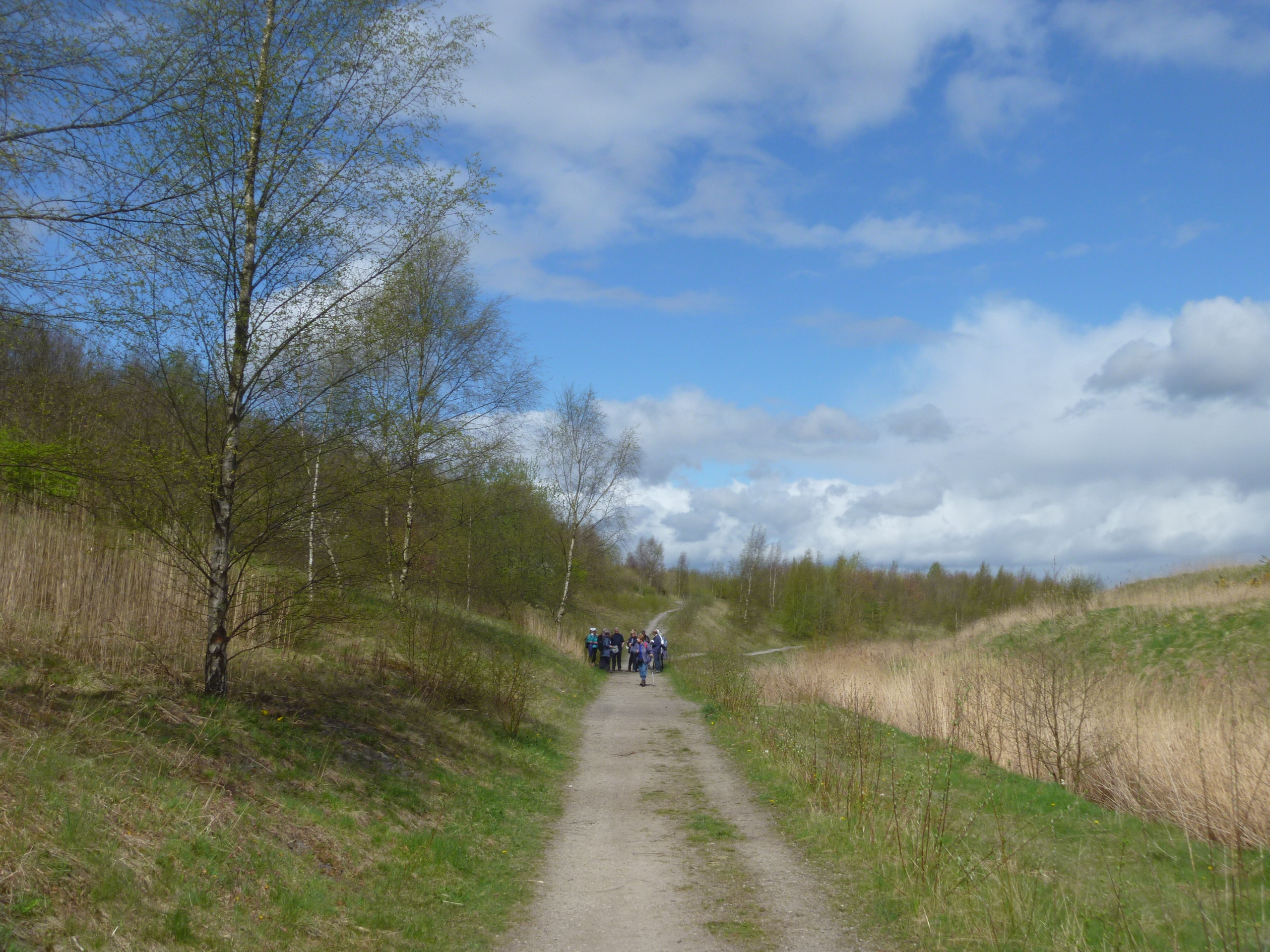
Yet again we had a great Route Manager to help us along the way, give advice, transport our bags and generally be a presence in the background in case of need. The Route Booklet explains the route step by step and we are now very familiar with the distances and what to expect. However, the ever-helpful Matteo explained that in certain places he had attached ‘environmentally-friendly’ blue tape not to show us the way but just to confirm that we were on the right track. It was always a relief to spot this tape! blue tape

Spotting Matteo’s blue tape

In brief, we walked from Manfredonia to Vieste officially a distance of 41.1 miles but we are positive that we walked a lot further than that! (… and I have the Fitbit to prove it!). ATG sum up the walk thus : “Limestone hills rising to 2,700 feet with coastal paths, quiet lanes, farm and woodland tracks and pilgrim routes leading up to Monte Sant’ Angelo. Occasionally rough under foot.” leaving first hotel

Leaving our first hotel

There was a long, but pleasant, walk from the first hotel along the promenade into the town centre of Manfredonia. Here we lingered a while viewing the Cathedral, the Castle and Town Hall Courtyard and Museum. Main Street Manfredonia

‘The Corso Manfredi’, Manfredonia

City Hall and Museum Manfredonia

Town Hall

Cathedral Manfredonia

Cathedral

Castle Manfredonia

Castle

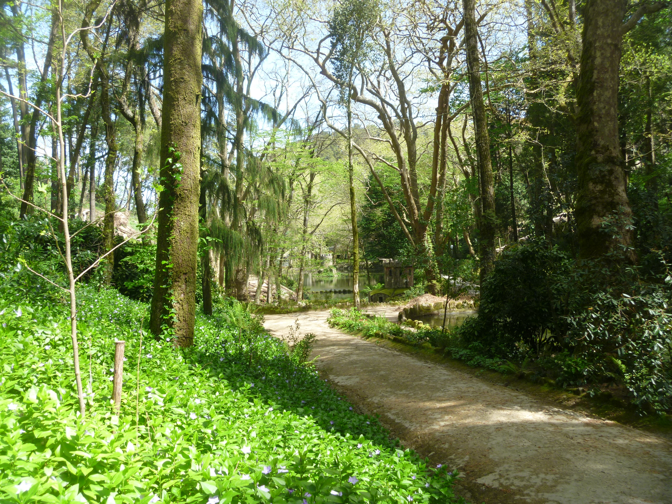
There followed an even longer walk out of the town and through olive groves across the coastal plain before we even started on the “Jazzo Ognissanti” the historical and natural path.

There's Mont St Angelo

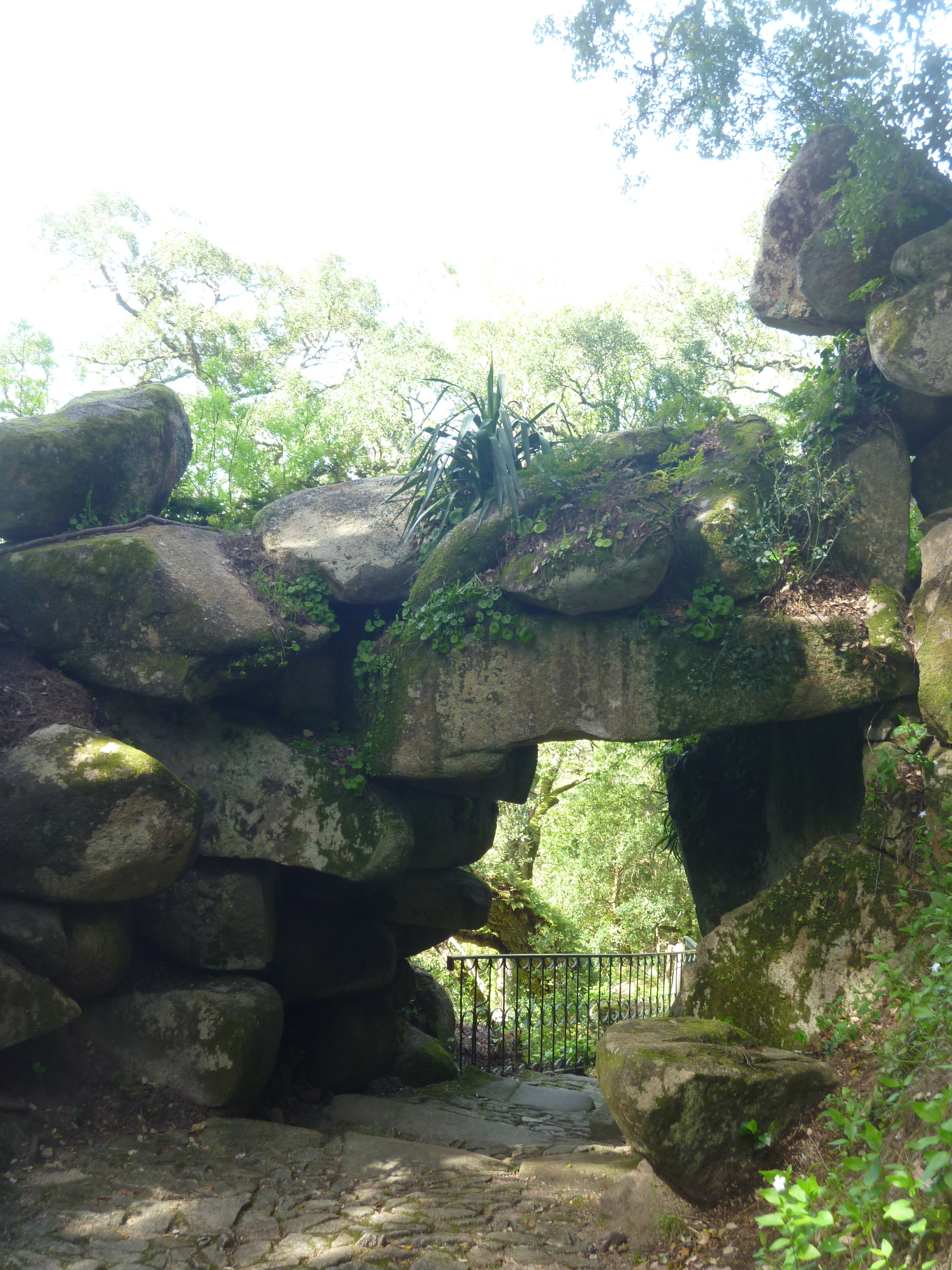
We Climbed Right Up There!

Walk along the coast then across a small plain before ascending an ancient pilgrim route, once used by crusaders before they embarked for the Holy Land. The route, now a grassy ravine with ruined monasteries on either side, leads to the ancient town of Monte Sant’Angelo (2,755ft), with its whitewashed houses, steep narrow alleys and stairways, and views across the bay of Manfredonia and coast to the south.” Pilgrim Route info boards along the way View back to Manfredonia The Pilgrim Route to Monte Sant’Angelo was memorably tough but very special and we enjoyed exploring the town the next day visiting the Sanctuary of St Michael the Archangel, churches and the Old Town (the JUNNO Medieval District) before heading off on the next stage (and getting soaking wet twice in the process) to our next stop, Mattinata. streets of Monte st  angelo

Shop

Shops selling religious mementoes abound in Monte Sant’Angelo

Santuario

Santuario door

The Santuario Door

santa maria door

Door to the Church of Santa Maria Maggiore

Time to explore the town and visit the famous cave church, venerated as being the last place St Michael appeared on earth in 491 AD, before setting off down a well-made pilgrim path to the small town of Mattinata (650ft) set in olive groves, close to the coast.”You descend from 800m to sea level on rocky paths, stony mountainsides and through woods, with wide views of Mattinata and the coast, following the remains of an old mule track called ‘Strada Comunale Mattinata – Monte Sant’Angelo’, which was once the only way up!” pagliaio On this section we came across pagliaio: shelters that were once used by shepherds to keep grain and straw for their herds and to sleep in if necessary. We had lunch in the shelter of one as it poured with rain. Later in another, even worse, downpour we sheltered under some trees but these made little or no difference. a pagliaio and storm clouds

A Pagliaio with storm clouds brewing

Mattinata looked like a nice town but we didn’t stop to find out as the shops were closed in the early Saturday afternoon and we needed badly to dry out our boots and clothes. The local museums had strange opening hours. The Museo Civico 5-10pm Tuesdays and Saturdays and a Museum in the local pharmacy was also open on that Saturday evening. In the end we just couldn’t face getting wet again.

Sunday dawned bright and clear and the walk on that lovely day was virtually over by lunchtime when we arrived at the beach. We ate a leisurely lunch then hiked the final couple of kilometres to our hotel. lunch venue

We looked rather out of place in our hiking gear!

The route undulates across two valleys following surfaced road, grassy and stony paths and along a high ridgeline path with wide views east and west to the sea, before descending and across a wide plain. The route brings you close to the shore and along it before a brief section on road to the hotel.” beach

The Beach from our dinner table

Except for Monte Sant’Angelo and Vieste our hotel arrangements were on a half board basis. This is ATG policy when a hotel is not near a choice of good restaurants. The Hotel Villa Scapone is set on a cliff: walk down to the pool and up to the restaurant from our individual room with separate entrance and private terrace. It was a wonderful place to spend a relaxing Sunday evening halfway through our journey. Hotel Scapone

The Hotel Villa Scapone, Baia Fontana delle Rose

Advertisement

Acquapendente to Bolsena and Bolsena to Orvieto

Day 6

Free day in Bolsena: Explore Bolsena, its ancient streets, castle, Etruscan temples and church, and catacombs of Santa Cristina, site of the miracle of Corpus Christi. Swimming in the lake. Optional walk from Acquapendente through the low Monti Volsinii (12.2 miles, 6 hours).

Bolsena

Bolsena comes into view as we complete our walk from Acquapendente

Being gluttons for punishment of course we’d decided all along on the optional walk from Acquapendente. Lucky for us that Tuesday morning had been assigned by Annalisa as our ‘feedback’ time for the trip. So, as previously arranged, we met Annalisa in the hotel lobby and gave our views on the walks and hotels, restaurants etc. This slightly delayed our departure so A, whose home is in Acquapendente, offered us a lift to the start of the walk advising on places to buy lunch and water for the day. We bid her a very fond farewell as she drove off to her next assignment.

Farewell Annalisa

Goodbye Annalisa and Thank you! – Keep Smiling! You’re doing a great job!

Day 7

Bolsena to Orvieto: An old Etruscan lane leads up through woods to a plateau and across farmland. The first view of Orvieto, situated high on its extinct volcano, is unforgettable (11.3 miles, 5.5 hours). Don’t miss the magnificent cathedral with frescoes.

Wednesday, the final day of our journey to Orvieto, the weather was back to its usual blue sky and sunshine. We walked up through the old town of Bolsena and up out of the crater following a paved Roman Road and an Etruscan Lane. We were told that the route follows the historic trail of the procession of the Miracle of Bolsena.

Lake Bolsena last morning

Lake Bolsena as we leave the town

Bolsena 1

Historic Bolsena

Bolsena 2

Old Bolsena

La Medusa  Shop

La Medusa Shop – Maker of Replica Roman/Etruscan Artefacts??

La Medusa

La Medusa

Bolsena rooftops

The Rooftops and Lake – Bolsena

Bolsena Castle

Bolsena Castle

Leaving the town we soon turned from the tarmac road onto a long ancient track. “You are now walking on the old paved Roman Road to Orvieto with the flagstones clearly visible underfoot” declared the Route Booklet. I think possibly our route diverted quite a bit from the typical Roman straight-line road but we certainly approached Orvieto downhill and then uphill in a straight line.

Roman Road

The Roman Road leaving Bolsena

Ronman Road 2

Flagstones clearly visible underfoot

We crossed the border from Lazio into Umbria (Bolsena and Acquapendente are both in Lazio we left Tuscany behind between San Quirico and Latera on Monday). A couple of kilometres later we visited our final 9 Etruscan tombs. They appeared rather abandoned and the Information Board had been stripped of all information. About 5 km from our hotel in Orvieto we had our first view of the city perched on its extinct volcanic rock.

Some of 9 Etruscan tombs

Some of the 9 Etruscan Tombs

First view of Orvieto

Our first view of Orvieto

We made it! We arrived at our hotel in Orvieto with a great feeling of satisfaction and achievement. Our last night was spent in Orvieto but although the ATG holiday finished with breakfast the next day we were to travel on to Rome for a further night before returning to Yorkshire on Friday.

Orvieto Cathedral 1

The Orvieto Duomo or Cathedral at night

Orvieto Cathedral day

Begun in 1290 it is probably the finest example of Romanesque Gothic in Italy – The Duomo by day

Like our achievement – Magnificent!!


Sovana to Bolsena – Tracks and Tombs and Troglodytes … and Rain

Day 4

Sovana to San Quirico: Paths across farmland lead to an isolated church and fine Etruscan lane that descends into a gorge, from which rises crag-top Sorano. After exploring Sorano, paths along the gorge lead to the troglodyte habitations at Vitozza and the village of San Quirico (10.3 miles, 5 hours).

On the Sunday the walking began in earnest. Over 40 miles in 4 days – not bad going!

Church of San Rocco

The Abandoned Isolated Church of San Rocco

Sorana

Crag-top Sorana from San Rocco Viewpoint

Via Cava San Rocco

Etruscan Lane of San Rocco

Via Cava SR tomb

Tombs along the Via Cava di San Rocco

Near the village of San Quirico (our destination on Day 4) we passed through the abandoned troglodyte village of Vitozza. This fascinating, rather eerie, place had been a medieval settlement dating back to the 12th century. There are the remains of castles, churches, and many other buildings plus many caves which were used as stables, storerooms and homes.

Troglodite homes Vitozza

Vitozza groto

Vitoza caves

Cave homes at Vitozza

Il Colombaio Vitozza

Dovecote or Columbario – 1st Century AD

Day 5

San Quirico to Bolsena: Cart tracks across farmland lead to an escarpment, where paths descend towards the small town of Latera. A climb through chestnut woods to the rim of a volcanic crater offers superb views. Tracks lead down to Lake Bolsena (10.4 miles, 5.5 hours), from where a private boat takes you across the lake to Bolsena (town).

Latera

Approaching Latera

Latera Square

We ate our picnic lunch on a bench in this square in Latera: Church of San Clemente and 1790 bell-tower

Pretty doorway in Latera

Pretty Doorway in Latera Piazza San Clemente

Leaing Latera

Leaving Latera

After leaving Latera and as we approached the crater edge with views of Lake Bolsena the rain began. Unfortunately, this meant that we were unable to take the boat trip across the lake. Annalisa had to come to our rescue and drive us round the lake to our next hotel by the lakeside at Bolsena.

A herd of sheep blocked our path

Our path is blocked by sheep – but not for too long!

Lake Bolsena in the rain

An early view of Lake Bolsena in the rain

Lake Bolsena

We arrive at the Trattoria Da Giggetto jetty


Tracks and Tombs around Sovana, Tuscany

“Day 2

Pitigliano to Sovana: Free morning to explore crag-top Pitigliano, its Etruscan houses, medieval fortress and synagogue. Then follow an Etruscan lane to a small plateau, with pastures and vines, to the charming village of Sovana (4.9 miles, 3 hours).

Day 3

Free day in Sovana: Visit Sovana’s fine Romanesque churches. Walk to see the outstanding Etruscan necropolis, including the Tomba della Sirena, restored by the ATG Trust (2.5 miles).”

After breakfast and our orientation meeting with Annalisa we set off on our first day’s walking. We felt that we had explored Pitigliano sufficiently the previous afternoon and were happy to get started with the walk in earnest.

Our next port-of-call was to be Sovana a pretty village, popular with day visitors (especially so probably because Friday 25 April was an Italian public holiday and the weather was good), just a few miles from Pitigliano.

Our path lead us through further fine examples of Vie Cave, past ancient Etruscan tombs carved out of the local tufa rock and along the ubiquitous strada bianca (small gravel country roads connecting farms) – marked ‘SB’ in our trusty route booklet.

Via Cava di San Giuseppe

Via Cava di San Giuseppe

Etruscan Tombs

Etruscan Tombs – good examples of ‘tomba a camera’

strada bianca

Our first Strada Bianca

After this relatively easy walk along open tracks and through woodland and further vie cave we arrived in Sovana in the early afternoon allowing us plenty of time to have lunch, explore the village and relax in the beautiful gardens of the Sovana Hotel and Resort right next door to the ancient Duomo.

Main piazza Sovana

Arriving in the main Piazza in Sovana

Via del Duomo

The Via Del Duomo, Sovana

Sovana Duomo

The Romanesque Duomo from the hotel gardens

Duomo from hotel window

The Duomo from the Hotel window

Carved Cathedral Door

The Carved Cathedral Doorway

It was lovely to spend two nights at the Sovana Hotel. The ‘free’ day was a Saturday and many people were visiting the village but our circular walk was mostly very quiet although we did join some others at the necropolis Parco Archeologico “Citta’ del Tufo” 

Discovered by S.J. Ainsley and George Dennis in 1843, the Etruscan Tombs are situated along the road from Sovana to S. Martino Sul Fiora. This valley, lined with tombs, is possibly the best preserved Etruscan necropolis. Whilst the tombs themselves are underground, above many of them Greek ‘temple’ style monuments have been carved into the rock. They were not only burial tombs but the flights of steps up the ‘temples’ meant they were places of worship as well. They were stuccoed and painted.” [Adapted from the Route Booklet]

At the Parco Archeologico

Tomba Pola

Tomba Pola

TP Impression

Artist’s Impression of the Tomba Pola

Ildebranda tomb

Tomba Ildebranda

IT column

Close-up view of the column at the Tomba Ildebranda

About the Tomba Ildebranda it says in the Route Booklet : “The magnificent tomb/temple was discovered only in 1925 and named in honour of Pope Gregory (who was previously Ildebrando [and born in Sovana in the Middle Ages], with whom the tomb clearly has nothing whatsoever to do! It was evidently the tomb of some wealthy, Etruscan-Roman governor of the municipium. It has an exterior resembling a Greek temple, with pillars and roof – all carved out of the rock in the 3rd to 2nd centuries BC.”

LTDS picture

La Tomba della Sirena impression

A short walk away and across the road from the Tomba Ildebranda etc is the Tomba della Sirena [Tomb of the Mermaid] the restoration of which was partly paid for by the ATG Trust. Dating back to 250 BC it was the first tomb to be discovered by Ainsley and Dennis in 1843.

LTDS notice

 La Tomba della Sirena from the Information Board

La Tomba della sirena

La Tomba della Sirena

LTDS ATG

La Tomba della Sirena – Acknowledgement of ATG Contribution

Via Cava SS

The now closed-off Via Cava di San Sebastiano

We spent much of the morning inspecting the tombs area and then completed the circular walk back to Sovana for lunch again at a pavement cafe on the Via del Duomo. We had hoped to take the opportunity this afternoon to visit one of the nearby thermal springs. Before the trip we had understood them to be within a short distance of the village but it turned out that they were over 20 kms away, were located within private spa resorts and transport seemed complicated and not helped by it being a public holiday weekend. They also threatened to be very busy. In the end we opted to relax again in the afternoon in preparation for the next four days walking – over 10 miles each day!


Etruscan Lanes to Orvieto – Day One – We arrive at Pitigliano

ATG’s most unusual trip!

“Crag-top towns approached by ancient Via di Cava, then lakes and plateaux, and finally Orvieto with its magnificent cathedral.”

This was our ATG Footloose Walking Holiday this year. Our third altogether. My sister and I travelled to Italy on 24 April and returned last Friday 2nd May. We flew to Rome from Leeds Bradford Airport where we were met by a driver and his Mercedes limousine in which we travelled in style and comfort for two hours to the picturesque town of Pitigliano in the very south of Tuscany.

Pitigliano from Hotel window

Pitigliano from our hotel window

Day 1

“Arrive in Pitigliano: Dramatic approach to Pitigliano on foot (1 mile) via 2,500-year-old Etruscan lanes is strongly recommended. Alternatively this walk can be done as an excursion after arrival (2 miles).”

After settling into our room we soon set off on the excursion recommended above by ATG. Here are some highlights from that walk.

Aqueduct Pitigliano

The Aqueduct “Built in 1545 by Sangallo for the Orsinis”

Romanesque wall panel

The Romanesque wall panel depicting Christianity defeating evil on the wall of the church of San Rocco, Pitigliano

Pitigliano from viewpoint

View of Pitigliano from the Church of Madonna delle Grazie

Typical Via Cava

Returning to Pitigliano via a Via Cava

Vie Cave : Our first Etruscan Via Cava – “cut by hand from volcanic tufa rock between 2,000 and 3,000 years ago. They were the main routes to crag-top towns such as Pitigliano and used for millennia by travellers and local farmers with their flocks and herds. Their scale carefully planned gradients, drainage channels, walk-ways and steps for animals make the Via Cava one of the major engineering achievements of the era. Some are still in regular use today, although tree roots during the past 2,000 years has caused rock falls and blocked others.”

We walked along many Vie Cave on the first few days of the trip. The friendly dog accompanied us from town to the viewpoint and we wondered how we would shake him off but when we arrived back in town he joined up with a small group of walkers heading out on the same route we had just taken.

Typical Etruscan Tomb

A typical Etruscan Tomb

Another feature of the walk that occurred again and again was the Etruscan tomb. On this first day we passed through a ‘honeycomb’ of tombs on our path out of, and back into, Pitigliano. Many are now used for wine storage and for farm implements.

Before we began our trek to Orvieto the next day we met our Route Manager – always a highlight of ATG holidays – Annalisa! She helped to make our trip as successful as it was. Thank you so much, Annalisa!

With Annalisa

Meeting Annalisa at the Hotel Guastini in Pitigliano before we started our journey

Bolsover Castle to Hardwick Hall, and back, and on foot

This month’s ATG Saturday Walk is a new one for them (and for me) : ‘Bolsover and Hardwick Hall’.

Here’s the itinerary :

Starting alongside the impressive 17th century castle of Bolsover, this walks heads south along the Doe Lea, passing the Saxon church at Ault Hucknall en route to the impressive Elizabethan home of Bess of Hardwick – Hardwick Hall. After strolling through the extensive grounds, we head north back to Glapwell for lunch. After lunch, quiet farmland tracks take us back to Bolsover for tea. 12.75 miles.” [ATG brochure]

I was so attracted by the idea of the walk and its route and the fact that today I would be travelling down the M1 from Leeds to Leicester with a whole day to spare that I failed to register quite the distance involved! There are opportunities to be picked up and returned comfortably to the start/end from both at Hardwick and at Glapwell but most of us soldiered on to the end. Luckily the route is not too demanding as regards climbs but it’s quite a long tramp and I’m now happily down in Leicetershire.

Bolsover Castle

I’ve written about Bolsover Castle before – a misty, foggy visit in November 2011. Today we passed through several weathers but only one brief shower otherwise sunshine, cloud, heavy black threatening cloud and cold winds all took it in turns.

New Bolsover

New Bolsover

From Bolsover town we headed down below the Castle to New Bolsover which is actually not so new just newer than the old settlement around the Castle. It was a purpose-built miners’ village of neat red-brick terrace houses enclosing a large grassy area and is still occupied today even though the pits around this coalfield closed in the 1990s.

In New Bolsover

In New Bolsover

The theme of much of the walk was past or along the remains of the coal industry: along a disused railway track and past grassed over open cast mines on the Stockley Ponds and Trail maintained by Bolsover Countryside Partnership.

We could still see Bolsover Castle

We could still see Bolsover Castle

The Stockley Trail

The Stockley Trail

Stockley Ponds

The Stockley Ponds (Beware! Contaminated water) no fishing today

Apart from the two very significant buildings – Hardwick Hall (NT) and Bolsover Castle – we stopped by a small Saxon Church. The Church of St John the Baptist at Ault Hucknall was closed unfortunately but it would have been good to get inside. Read more about its chapel, windows and the grave of Thomas Hobbes, the author of The Leviathan, here.

St John's Ault Hucknall

St John the Baptist Church, Ault Hucknall

Saxon Arch and figures

Saxon Arch with figures

Close-up of the Saxon Arch

Saxon Arch details

Saxon Window

Saxon Window

By lunchtime we’d arrived at Hardwick Hall, “more glass than wall”.

Approaching Hardwick Hall

Approaching Hardwick Hall

Hardwick Hall More Glass than Wall

Hardwick Hall

But it wasn’t our lunchtime so we just walked through the grounds, admiring the house as we went and continued along Lady Spencer’s Walk and other tracks on the estate finally arriving at Glapwell where lunch was waiting for us in the Community Centre.

Lady Spencer's Walk

Our Leader, Rob

Hardwick Hall avenue

Hardwick Hall from the Avenue of Trees

Comfortably refreshed, the best part of the walk, although fairly short now, lay ahead. After crossing several fields we followed a ridge directly back up to Bolsover with magnificent views west right across to the Derbyshire Dales.

Return to Bolsover

Return to Bolsover

Arriving in Bolsover more sustenance awaited us at The Bluebell pub – a generous spread of home baked scones, butter, cream and jam and pots of tea, to boot.

Less than an hour’s drive I am comfortably ensconced in my homely B&B for the night!

Footloose in Lisbon : walking and climbing in the city

The ATG holiday finished after breakfast on Saturday morning. We’d eaten early and walked down to Sintra Station for the 40 minute train journey to Lisbon Rossio Station. We passed the National Palace on our way. It’s on my list for my next visit!

National Palace Sintra

The National Palace, Sintra

We’d added an extra night to the trip so that we might gain a flavour of Portugal’s capital city. From Rossio Square it was a 20 minute walk to our B&B in the shadow of the Sé Cathedral in the medieval Alfama district. Our hostess Teresa met us and let us leave our bags giving us a local map and a few suggestions for a day’s walking in Lisbon.

The hill and step climbing didn’t stop at the end of the walking holiday. Lisbon is a hilly city. First off we walked along the route of the famous old 28 tram up to the viewpoints at Santa Luzia and Portas do Sol Squares. Fantastic views over Lisbon and its port, Alfama and the River Tagus.

Alfama from Sta Luzia Square

Alfama District from Santa Luzia Square

Tiled wall at Santa Luzia Square

Tiled wall at Santa Luzia Square

Tram 28 at the busy Portas do Sol

Tram 28 at the busy Portas do Sol

Portas do Sol Square

Portas do Sol Square

Further climbing brought us to the end of the queue for the ticket office for the Castelo Sao Jorge. Once inside the Castle grounds you can take in fantastic city views from the busy esplanade, visit the archaeological museum, walk the battlements and see the ongoing Moorish excavations and shady gardens. Considered to be the site of the founding settlement of Lisbon recent archaeological finds date back to the late 6th C BC. The castle remains themselves are from the Moorish era (11th and 12th C). St George’s Castle was a royal residence until 1511. For centuries then it was neglected but today it’s an attractive place to visit and we spent the best part of the morning until the early afternoon exploring and admiring the views at every turn.

Lisbon, River Tagus and  25 April Bridge from the Castle Esplanade

Lisbon, River Tagus and  25 April Bridge from the Castle Esplanade

Shady Esplanade at S Jorge Castle

Shady Esplanade at S Jorge Castle

Tile Frame Border in the Archeaological Museum

Tile Frame Border in the Archeaological Museum

This is a representation of angels. Blue and white tiles with manganese. Produced domestically. Late 17th C. [Exhibit notes]

Moorish Excavations

Moorish Excavations

Next up was a wander around Alfama – taking note of possible evening meal locations – and ending up at the popular, Bohemian-style Pois Cafe very near Sé Cathedral the next place on our itinerary.

Street in Alfama 1

Street in Alfama

Street in Alfama 2

Quiet Square in Alfama

Lisbon’s Cathedral, built not long after Dom Afonso Henriques took Lisbon from the Moors in 1147, stands on the site of city’s main mosque. The crenellated Romanesque building is a reconstruction and restoration since most of Lisbon was destroyed by earthquake in 1755.

Se Cathedral near our B&B

Sé Cathedral near our B&B

It is also an important archaeological site and new finds are constantly being added to the inventory from the cloister excavations originally started to reinforce the building’s foundations. We explored the Cloister and the Treasury at extra charge. The highlight of the church is the Rose Window.

Excavations in Se Cathedral Cloister

Excavations in Sé Cathedral Cloister

The Rose Window

The Rose Window

The cathedral is very dark inside and so we blinked when eventually we emerged into the sunny Lisbon afternoon. We then walked across the main shopping streets, the pedestrianised rua Augusta is the main shopping drag, to the famous Elevador da Santa Justa. This lift, designed by the Portuguese pupil of Gustave  Eiffel (and you can see the connection!) Raoul Mesnier de Ponsard, takes you up in its neo-Gothic lift to the ruin of Carmo and its busy square. When you come out of the lift there’s a tight little iron spiral staircase that takes you up to yet another amazing viewpoint.

Elevador de Santa Justa

Elevador de Santa Justa

Castle from the viewing platform

Castle from the viewing platform of the Elevador

The Cathedral and Tagus from the Viewing Platform

The Cathedral and Tagus from the Viewing Platform

Rossio Square from the Viewing Platform

Rossio Square from the Viewing Platform (note the wavy pavements which seem to reflect the watery nature of the city)

As time was tight we decided that we would have to forego a visit to Belem – highly recommended by both Teresa and Ana. As I always say – “One must leave something for one’s next visit”.

“Lo! Cintra’s glorious Eden” – A Day in Sintra

Here you will see that Lord Byron’s declamation still holds true today!

Our walk continued from Praia Grande for a further two days. We continued up the coast as far north as Praia de Magoito where the Sintra natural park ends and then turned inland away from the ocean views to the wine growing area of Colares. The town of Colares was  where we spent the next night and our journey on foot continued the next day to Sintra itself via a long stop at the wonderful Palace and Gardens of Monserrate.

Monserrate Gardens

In the Gardens at Monserrate

Entrance Gate to Sintra

Former Entrance to Sintra

So, on the afternoon of the fifth day of walking we arrived at one of the former town gates and soon reached the famous Lawrence’s Hotel right in the old town of Sintra.

Lawrences

This hotel is the oldest in Spain and Portugal and (I believe) the second oldest in Europe. It has connections with Lord Byron who stayed here and whose portraits appear on many of the hotel and restaurant walls.

We stayed two nights at Lawrences which gave us a whole day to explore Sintra and its palaces.

Pena Palace

Most of our time was spent at the Park and Palace of Pena. It’s very popular; even on this Friday in April. There is lots to see in the Palace alone. Ongoing restoration could also be observed here as at Monserrate.

Open for Works at Pena

Tiled courtyard

An Inner Courtyard

The Park and Palace of Pena are the finest examples of nineteenth century Portuguese Romanticism and the integration of natural and built heritage. They constitute the most important part of the Cultural Landscape of  Sintra’s World Heritage site.” [From publicity leaflet]

Originally a chapel and later a monastery  in 1842 work began on a “New Palace” by the King Don Fernando II who left all the property on his death to his second wife the Countess Edla. The Palace and Park were acquired by the state in 1889 and converted to a museum in 1910-12.

A natural environment of rare beauty and scientific importance, the Park is remarkable as a project of landscape transformation of a hill, barren at the time, into an arboretum integrating several historic gardens. It occupies almost eighty-five hectares of exceptional geological and climatic conditions.” [From publicity leaflet]

The Chalet Edla

The Chalet Edla

We could have spent hours in the grounds alone. Leaving the Palace you are soon away from the crowds and we decided on a route that would take in the Chalet Edla.

Pena Park

Lush Greenery of the Pena Park

We had understood that due to damage following the storms in January the Chalet would not be open to the public. So we were surprised and happy to find that on that very day it was reopened  to the public! We bought our tickets and took a look round this unusual summer house built by Don Ferdinand for the Countess between 1864 and 1869. The Chalet also deteriorated badly over many years and in 1999 was damaged by fire. Here, again, renovation work is still ongoing. I’m not sure to what extent the recent storms damaged the house but there’s been a magnificent effort to restore this building to its former glory.

Before renovation

Photographs show the extent of the damage

Inside Edla 1

Interior Chalet Edla

Inside Edla 2

Renovations at The Chalet Edla

Inside Edla 3

Upstairs at The Chalet Edla

From the Pena gardens we stepped across the road to the Moorish Castle which is really just ramparts. But they are impressive  ramparts.Moorish Ramparts

The Moorish Castle Ramparts

Sintra from Moorish

Sintra from the Moorish Castle Ramparts

They tower over the town and we could see them from our terrace at Lawrences.

From our terrace

The Palace of Monserrate Restoration Project

Palace of Monserrate

In 1995 the whole of the Sintra Region was awarded UNESCO World Heritage status and restoration of the various properties and conservation of the forests and parks continues to this day.

Hall at Monserrate

The Beautifully Restored Hall

Since 1949 Monserrate has been owned by the Portuguese state. Over the decades that followed the palace deteriorated but in 2001 restoration work began on the roof and facades.  After interruptions this work was finally completed in 2004 when work on the interior could begin. A successful bid for funds from EEA-Grants in 2007 enabled work to resume at a faster pace. At Monserrate this the project is called “open for works” and it allows for the Palace to be open to the public so that all may watch the ongoing ‘interventions’.

Exquisite renovation work

Fantastic renovation work

Exquisite Plasterwork

Restoration work carried out room by room allowed for the re-opening of the building to visitors. So far interventions in the Library, Chapel, Kitchen, Pantry, Wine Cellar, Larders, decorative plasterwork, cleaning of stonework, kitchen range have all been carried out in sight of the visitors. It is wonderful to see the artists and craftspeople at work and many of the rooms being brought back into use, like The Music Room for concerts.

Restoration work in the music room

Music Room Plasterwork

The music room at Monserrate

The Music Room Today

Restored Music Room ceiling

The Restored Music Room Ceiling

Photographs on display in the Library show just how bad the condition of this fine room became during the latter half of the 20th century. Once the roof and walls were repaired work began on the individual rooms. Paying careful attention to detail the Library has now been recreated in its former glory.

The library before renovation

The library pre-renovation

The above two photos show the extent of the damage

The library now

The Library as it looks today

Example of library wallpaper

The Handmade Library Wallpaper

The library door

The Library Door

Library door (detail)

Detail of Library Door

The whole project makes me surprised that The Landmark Trust do not have an interest here as it definitely has the obligatory British connections that Landmark require of their overseas holdings. There are many follies and outbuildings ripe for occupation by we ‘Landmarkers’.

Childe Harold, Vathek and other literary inspirations of Monserrate

First glimpse of Monserrate Palace

On sloping mounds, or in the vale beneath,
Are domes where whilom kings did make repair;
But now the wild flowers round them only breathe:
Yet ruined splendour still is lingering there.
And yonder towers the prince’s palace fair:
There thou, too, Vathek! England’s wealthiest son,
Once formed thy Paradise, as not aware
When wanton Wealth her mightiest deeds hath done,
Meek Peace voluptuous lures was ever wont to shun.”

Childe Harold’s Pilgrimage, by Lord Byron [Canto the First XXII]

think the above verse applies to the beautiful palace and gardens of Monserrate. At least we were told in numerous books and leaflets that Lord Byron was smitten by Monserrate on his visit here in 1810 and reminisced about it in his poem ‘Childe Harold’s Pilgrimage’.

Monserrate Palace

Monserrate was probably my favourite place of the whole trip. It had everything: a palace with a library, exotic gardens(but with an English Rose Garden), a tea house, British connections, literary connections and to top it all we visited in beautiful weather!

The library today

The Library as it is today

In the gardens

In the exotic gardens

The Tea House

The Tea House

Beckford's Falls

Beckford’s Falls

William Beckford ordered this waterfall to be constructed between 1794 and 1799. Beckford, a writer who enjoyed great fame at the end of the 18th C, visited Portugal and fell in love with Sintra, where he rented this property from Gerard de Visme.” [On a nearby information board]

Vathek's Arch

Vathek’s Arch

This arch was built by William Beckford … We think that it could represent the entrance of the property which, at the time, was not enclosed. Beckford wrote his most famous book, Vathek, an oriental tale, in 1786 before his first visit to Portugal. Vathek was the hero of the book which is considered by many to be somehow autobiographic” [From nearby Information Board]

Gerard de Visme an English merchant holding the concession to import Brazilian teak was responsible for the construction of the first palace. Later, William Beckford, writer, novelist, art critic and eccentric lived here. There’s a waterfall named for him and an arch for his most famous character; Vathek.

Sir Francis Cooke bought the property in 1856 and had it restored by the English architect James Knowles, who employed a thousand workmen. In the 1850s the artist William Stockdale created a botanic garden there with plants including rhododendrons  from all over the world – Mexico, Australasia, Japan and the Himalayas.

Brass jugs in kitchen

Brass jugs in the kitchen – could be Below Stairs at any National Trust property!